
2 Bus Route Map
View the 2 route map and see all 2 stops along the route. The map of 2 shows where the bus travels and the location of each stop, making it easy to understand the entire route at a glance.
Explore SCAT - Tiemme routes on the map and see where SCAT - Tiemme bus services operate. Use the 2 map to find bus stops and see how the 2 connects different areas along its trip.
All 2 stops on the map are displayed in route order, helping you follow the 2 bus from the first stop to the last.
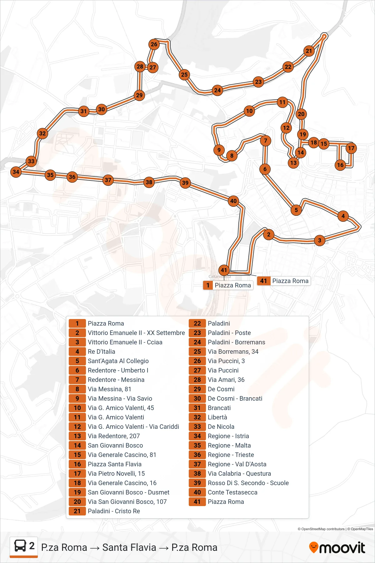
Stops list (2 - Piazza Roma to Santa Flavia Loop)
- Roma Square
- Vittorio Emanuele II - XX September
- Vittorio Emanuele II - Chamber of Commerce
- King's Street
- Sant'Agata At The College
- Redentore - Umberto I
- Redentore - Messina
- Messina Street, 81
- Via Messina - Via Savio
- Via G. Amico Valenti 45
- Via G. Amico Valenti
- Via G. Amico Valenti - Via Cariddi
- Redentore Street, 207
- San Giovanni Bosco
- Via Generale Cascino, 81
- Santa Flavia Square
- Pietro Novelli Street, 15
- 16 General Cascino Street
- San Giovanni Bosco - Dusmet
- 107 San Giovanni Bosco Street
- Paladini - Christ the King
- Paladini
- Paladini - Post Office
- Paladini - Borremans
- Borremans Street, 34
- Puccini Street 3
- Puccini Street
- Amari Street, 36
- De Cosmi
- De Cosmi - Brancati
- Brancati
- Libertà
- De Nicola
- Regione - Istria
- Region - Malta
- Region - Trieste
- Regione - Val D'Aosta
- Calabria Street - Police Headquarters
- Rosso Di San Secondo - Schools
- Conte Testasecca
- Roma Square