
2 Bus Route Map
View the 2 route map and see all 2 stops along the route. The map of 2 shows where the bus travels and the location of each stop, making it easy to understand the entire route at a glance.
Explore Bettendorf Transit routes on the map and see where Bettendorf Transit bus services operate. Use the 2 map to find bus stops and see how the 2 connects different areas along its trip.
All 2 stops on the map are displayed in route order, helping you follow the 2 bus from the first stop to the last.
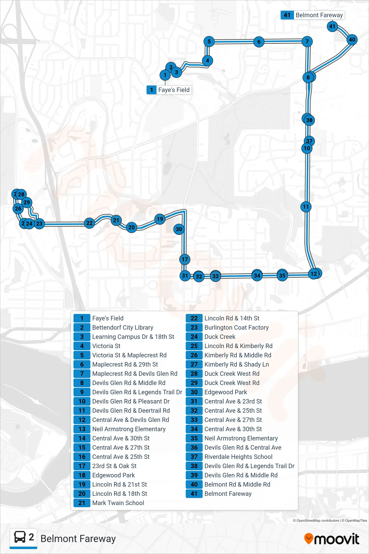
Stops list (2 - Belmont Fareway)
- Faye's Field
- Bettendorf City Library
- Learning Campus Dr & 18th St
- Victoria St
- Victoria St & Maplecrest Rd
- Maplecrest Rd & 29th St
- Maplecrest Rd & Devils Glen Rd
- Devils Glen Rd & Middle Rd
- Devils Glen Rd & Legends Trail Dr
- Devils Glen Rd & Pleasant Dr
- Devils Glen Rd & Deertrail Rd
- Central Ave & Devils Glen Rd
- Neil Armstrong Elementary
- Central Ave & 30th St
- Central Ave & 27th St
- Central Ave & 25th St
- 23rd St & Oak St
- Edgewood Park
- Lincoln Rd & 21st St
- Lincoln Rd & 18th St
- Mark Twain School
- Lincoln Rd & 14th St
- Burlington Coat Factory
- Duck Creek
- Lincoln Rd & Kimberly Rd
- Kimberly Rd & Middle Rd
- Kimberly Rd & Shady Ln
- Duck Creek West Rd
- Duck Creek West Rd
- Edgewood Park
- Central Ave & 23rd St
- Central Ave & 25th St
- Central Ave & 27th St
- Central Ave & 30th St
- Neil Armstrong Elementary
- Devils Glen Rd & Central Ave
- Riverdale Heights School
- Devils Glen Rd & Legends Trail Dr
- Devils Glen Rd & Middle Rd
- Belmont Rd & Middle Rd
- Belmont Fareway