
2 Subway Route Map
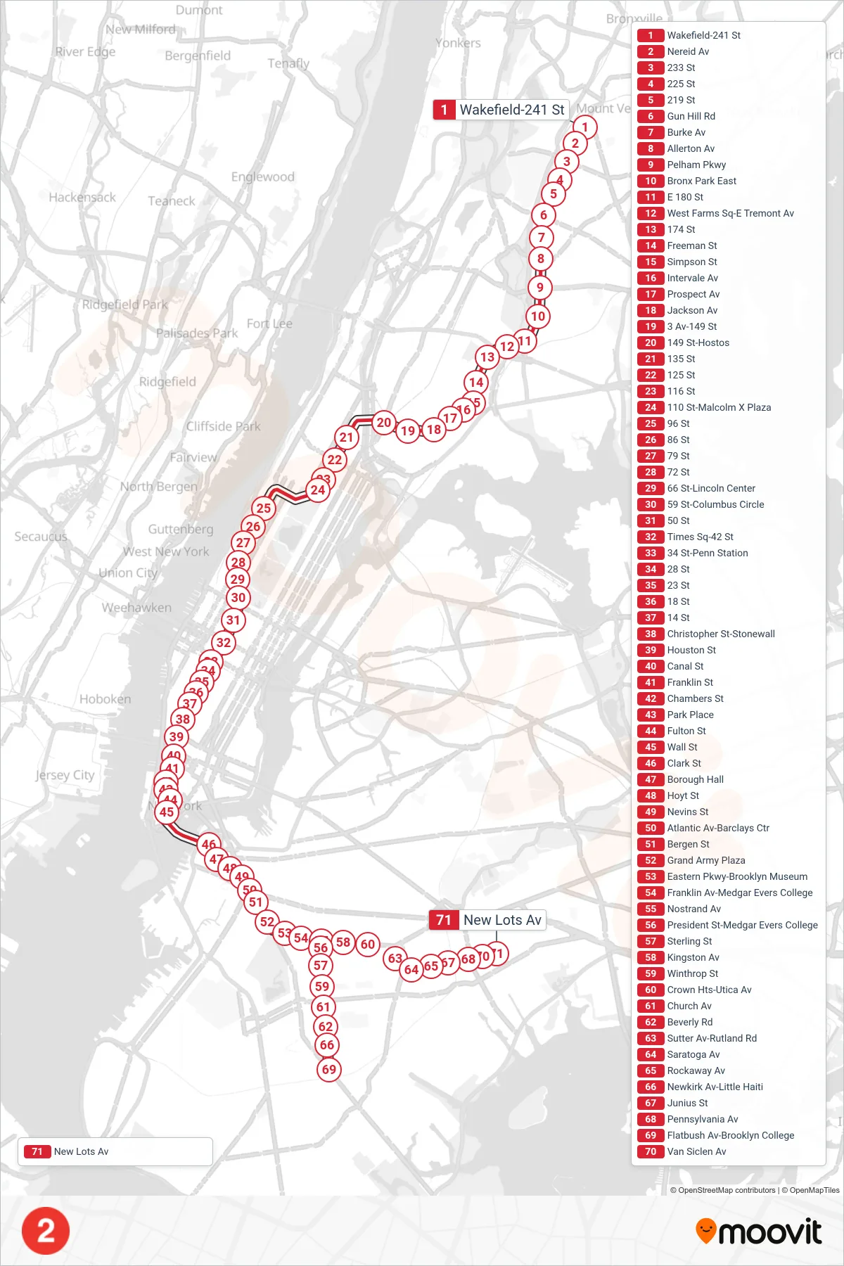
View the 2 route map and see all 2 stops along the route. The map of 2 shows where the subway travels and the location of each stop, making it easy to understand the entire route at a glance.
Explore MTA Subway routes on the map and see where MTA Subway subway services operate. Use the 2 map to find subway stations and see how the 2 connects different areas along its trip.
All 2 stops on the map are displayed in route order, helping you follow the 2 subway from the first station to the last.
Stops list (2 - Downtown & Brooklyn)
- Wakefield-241 St
- Nereid Av
- 233 St
- 225 St
- 219 St
- Gun Hill Rd
- Burke Av
- Allerton Av
- Pelham Pkwy
- Bronx Park East
- E 180 St
- West Farms Sq-E Tremont Av
- 174 St
- Freeman St
- Simpson St
- Intervale Av
- Prospect Av
- Jackson Av
- 3 Av-149 St
- 149 St-Hostos
- 135 St
- 125 St
- 116 St
- 110 St-Malcolm X Plaza
- 96 St
- 86 St
- 79 St
- 72 St
- 66 St-Lincoln Center
- 59 St-Columbus Circle
- 50 St
- Times Sq-42 St
- 34 St-Penn Station
- 28 St
- 23 St
- 18 St
- 14 St
- Christopher St-Stonewall
- Houston St
- Canal St
- Franklin St
- Chambers St
- Park Place
- Fulton St
- Wall St
- Clark St
- Borough Hall
- Hoyt St
- Nevins St
- Atlantic Av-Barclays Ctr
- Bergen St
- Grand Army Plaza
- Eastern Pkwy-Brooklyn Museum
- Franklin Av-Medgar Evers College
- Nostrand Av
- President St-Medgar Evers College
- Sterling St
- Kingston Av
- Winthrop St
- Crown Hts-Utica Av
- Church Av
- Beverly Rd
- Sutter Av-Rutland Rd
- Saratoga Av
- Rockaway Av
- Newkirk Av-Little Haiti
- Junius St
- Pennsylvania Av
- Flatbush Av-Brooklyn College
- Van Siclen Av
- New Lots Av