
2 Bus Route Map
View the 2 route map and see all 2 stops along the route. The map of 2 shows where the bus travels and the location of each stop, making it easy to understand the entire route at a glance.
Explore Arriva routes on the map and see where Arriva bus services operate. Use the 2 map to find bus stops and see how the 2 connects different areas along its trip.
All 2 stops on the map are displayed in route order, helping you follow the 2 bus from the first stop to the last.
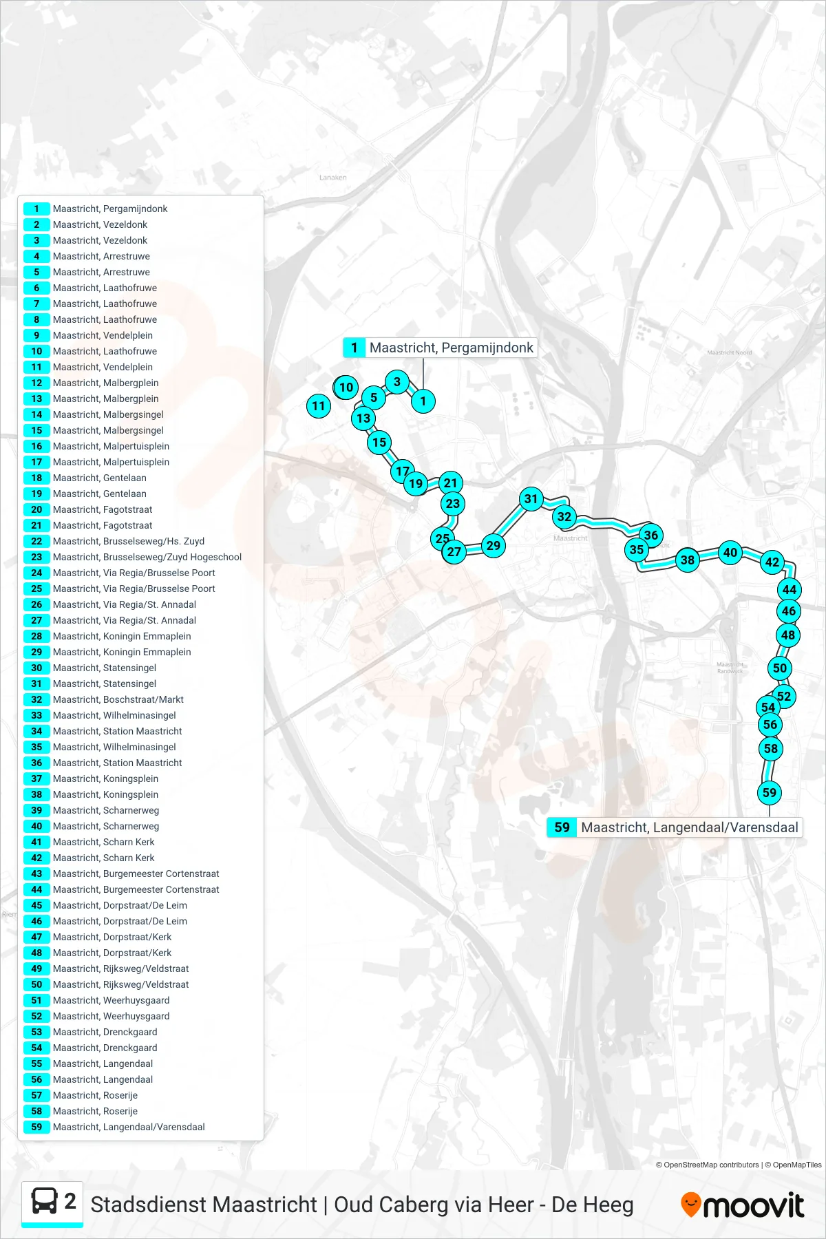

Stops list (2 - De Heeg)
- Maastricht, Pergamijndonk
- Maastricht, Vezeldonk
- Maastricht, Arrestruwe
- Maastricht, Laathofruwe
- Maastricht, Vendelplein
- Maastricht, Laathofruwe
- Maastricht, Malbergplein
- Maastricht, Malbergsingel
- Maastricht, Malpertuisplein
- Maastricht, Gentelaan
- Maastricht, Fagotstraat
- Maastricht, Brusselseweg/Hs. Zuyd
- Maastricht, Via Regia/Brusselse Poort
- Maastricht, Via Regia/St. Annadal
- Maastricht, Koningin Emmaplein
- Maastricht, Statensingel
- Maastricht, Boschstraat/Markt
- Maastricht, Station Maastricht
- Maastricht, Wilhelminasingel
- Maastricht, Koningsplein
- Maastricht, Scharnerweg
- Maastricht, Scharn Kerk
- Maastricht, Burgemeester Cortenstraat
- Maastricht, Dorpstraat/De Leim
- Maastricht, Dorpstraat/Kerk
- Maastricht, Rijksweg/Veldstraat
- Maastricht, Weerhuysgaard
- Maastricht, Drenckgaard
- Maastricht, Langendaal
- Maastricht, Roserije
- Maastricht, Langendaal/Varensdaal