
2 Tram Route Map
View the 2 route map and see all 2 stops along the route. The map of 2 shows where the tram travels and the location of each stop, making it easy to understand the entire route at a glance.
Explore routes on the map and see where tram services operate. Use the 2 map to find tram stations and see how the 2 connects different areas along its trip.
All 2 stops on the map are displayed in route order, helping you follow the 2 tram from the first station to the last.
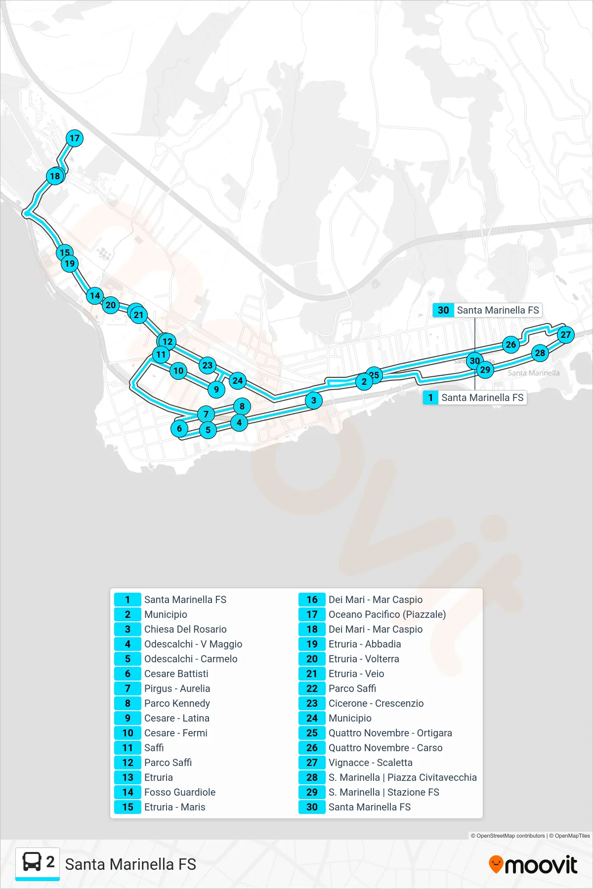
Stops list (2 - Santa Marinella Railway Station)
- Santa Marinella Railway Station
- City Hall
- Rosary Church
- Odescalchi - V Maggio
- Odescalchi - Carmelo
- Cesare Battisti
- Pirgus - Aurelia
- Kennedy Park
- Cesare - Latina
- Cesare - Fermi
- Saffi
- Saffi Park
- Etruria
- Fosso Guardiole
- Etruria - Maris
- Dei Mari - Caspian Sea
- Oceano Pacifico (Piazzale)
- Dei Mari - Caspian Sea
- Etruria - Abbadia
- Etruria - Volterra
- Etruria - Veio
- Saffi Park
- Cicerone - Crescenzio
- City Hall
- Quattro Novembre - Ortigara
- November Fourth - Carso
- Vignacce - Scaletta
- Santa Marinella Piazza Civitavecchia
- Santa Marinella | Railway Station
- Santa Marinella Railway Station