
2 Bus Route Map
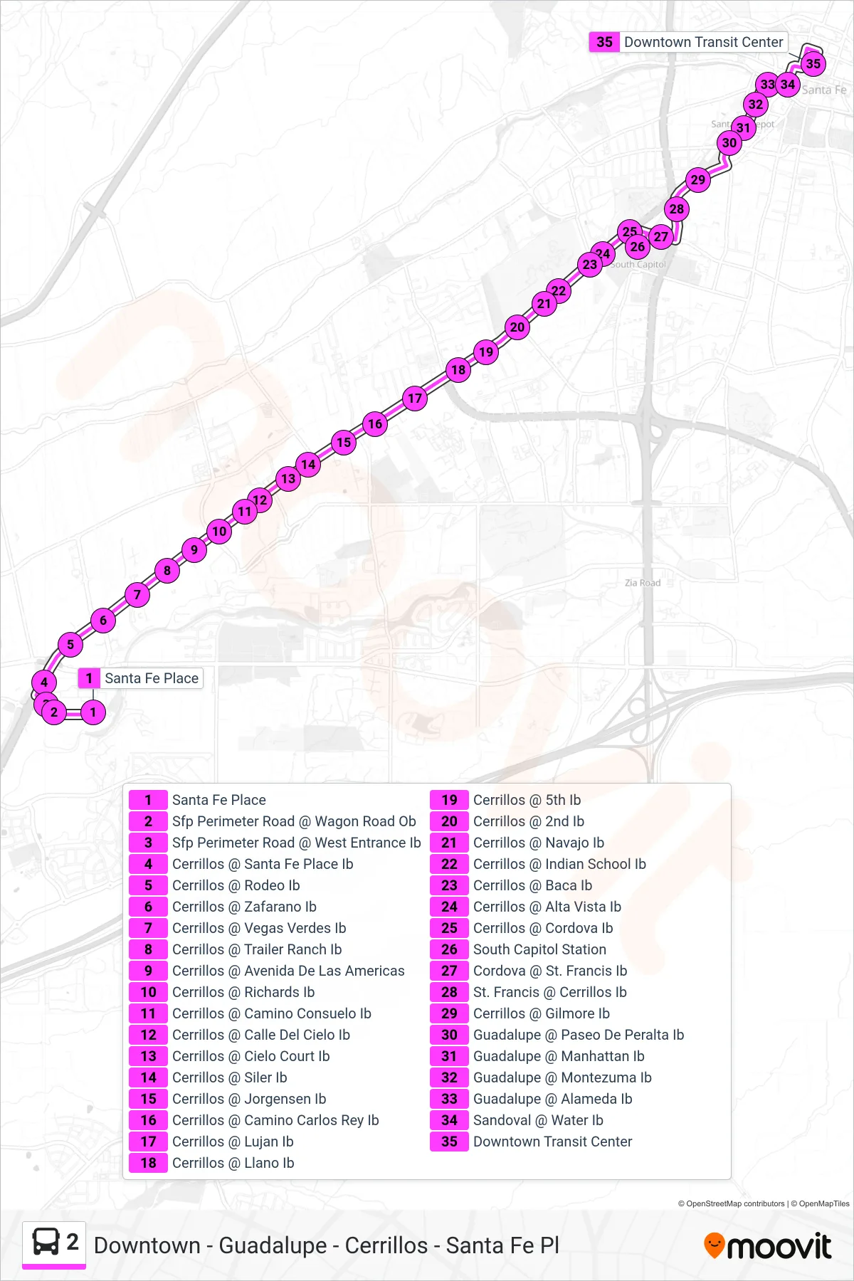
View the 2 route map and see all 2 stops along the route. The map of 2 shows where the bus travels and the location of each stop, making it easy to understand the entire route at a glance.
Explore Santa Fe Trails routes on the map and see where Santa Fe Trails bus services operate. Use the 2 map to find bus stops and see how the 2 connects different areas along its trip.
All 2 stops on the map are displayed in route order, helping you follow the 2 bus from the first stop to the last.
Stops list (2 - Downtown Transit Center)
- Santa Fe Place
- Sfp Perimeter Road @ Wagon Road Ob
- Sfp Perimeter Road @ West Entrance Ib
- Cerrillos @ Santa Fe Place Ib
- Cerrillos @ Rodeo Ib
- Cerrillos @ Zafarano Ib
- Cerrillos @ Vegas Verdes Ib
- Cerrillos @ Trailer Ranch Ib
- Cerrillos @ Avenida De Las Americas
- Cerrillos @ Richards Ib
- Cerrillos @ Camino Consuelo Ib
- Cerrillos @ Calle Del Cielo Ib
- Cerrillos @ Cielo Court Ib
- Cerrillos @ Siler Ib
- Cerrillos @ Jorgensen Ib
- Cerrillos @ Camino Carlos Rey Ib
- Cerrillos @ Lujan Ib
- Cerrillos @ Llano Ib
- Cerrillos @ 5th Ib
- Cerrillos @ 2nd Ib
- Cerrillos @ Navajo Ib
- Cerrillos @ Indian School Ib
- Cerrillos @ Baca Ib
- Cerrillos @ Alta Vista Ib
- Cerrillos @ Cordova Ib
- South Capitol Station
- Cordova @ St. Francis Ib
- St. Francis @ Cerrillos Ib
- Cerrillos @ Gilmore Ib
- Guadalupe @ Paseo De Peralta Ib
- Guadalupe @ Manhattan Ib
- Guadalupe @ Montezuma Ib
- Guadalupe @ Alameda Ib
- Sandoval @ Water Ib
- Downtown Transit Center