
2 Tram Route Map
View the 2 route map and see all 2 stops along the route. The map of 2 shows where the tram travels and the location of each stop, making it easy to understand the entire route at a glance.
Explore routes on the map and see where tram services operate. Use the 2 map to find tram stations and see how the 2 connects different areas along its trip.
All 2 stops on the map are displayed in route order, helping you follow the 2 tram from the first station to the last.
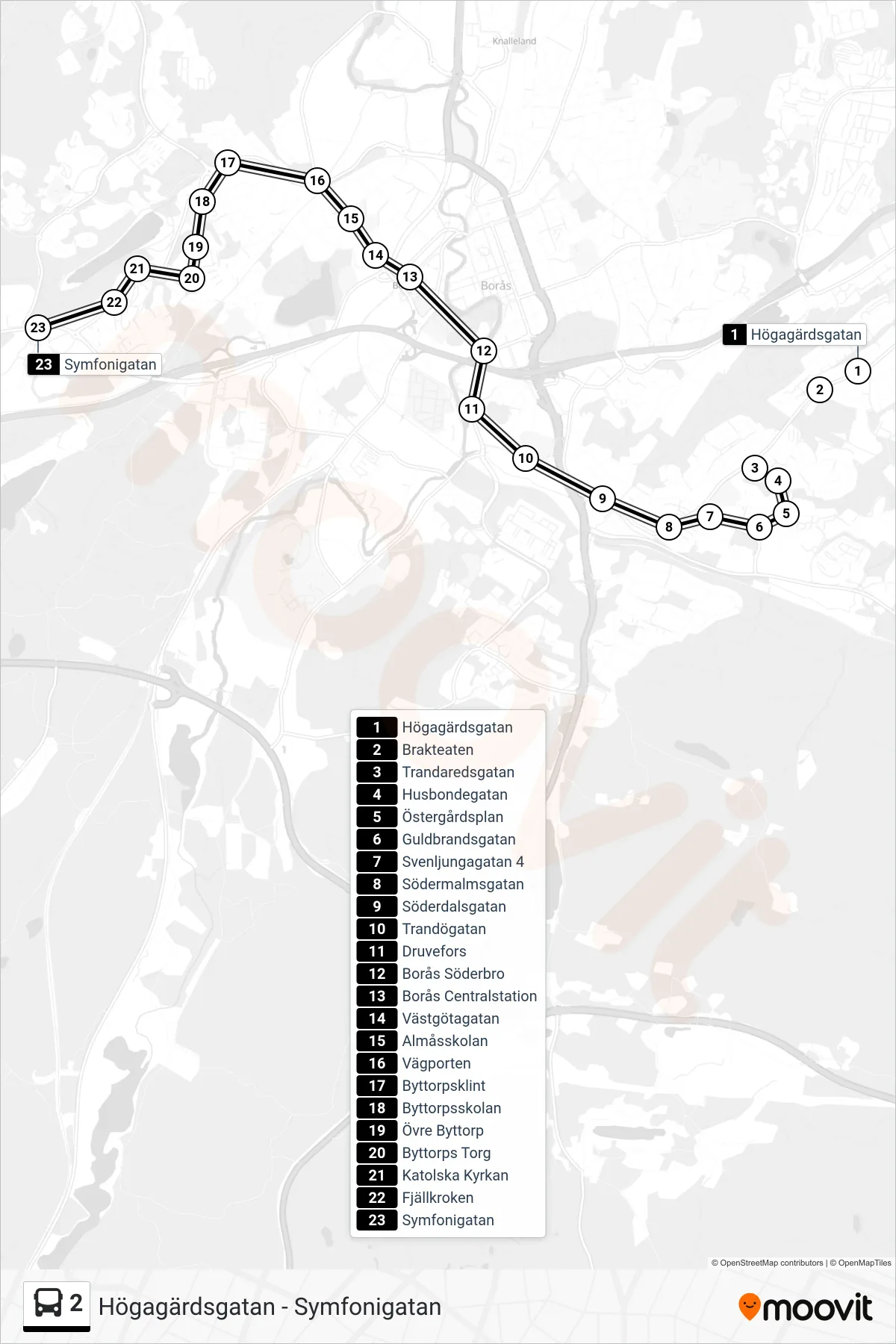
Stops list (2 - Symfonigatan)
- Högagärdsgatan
- Brakteaten
- Trandaredsgatan
- Husbondegatan
- Östergårdsplan
- Guldbrandsgatan
- Svenljungagatan 4
- Södermalmsgatan
- Söderdalsgatan
- Trandögatan
- Druvefors
- Borås Söderbro
- Borås Centralstation
- Västgötagatan
- Almåsskolan
- Vägporten
- Byttorpsklint
- Byttorpsskolan
- Övre Byttorp
- Byttorps Torg
- Katolska Kyrkan
- Fjällkroken
- Symfonigatan