
2 Light Rail Route Map
View the 2 route map and see all 2 stops along the route. The map of 2 shows where the light rail travels and the location of each stop, making it easy to understand the entire route at a glance.
Explore SWU routes on the map and see where SWU light rail services operate. Use the 2 map to find light rail stations and see how the 2 connects different areas along its trip.
All 2 stops on the map are displayed in route order, helping you follow the 2 light rail from the first station to the last.
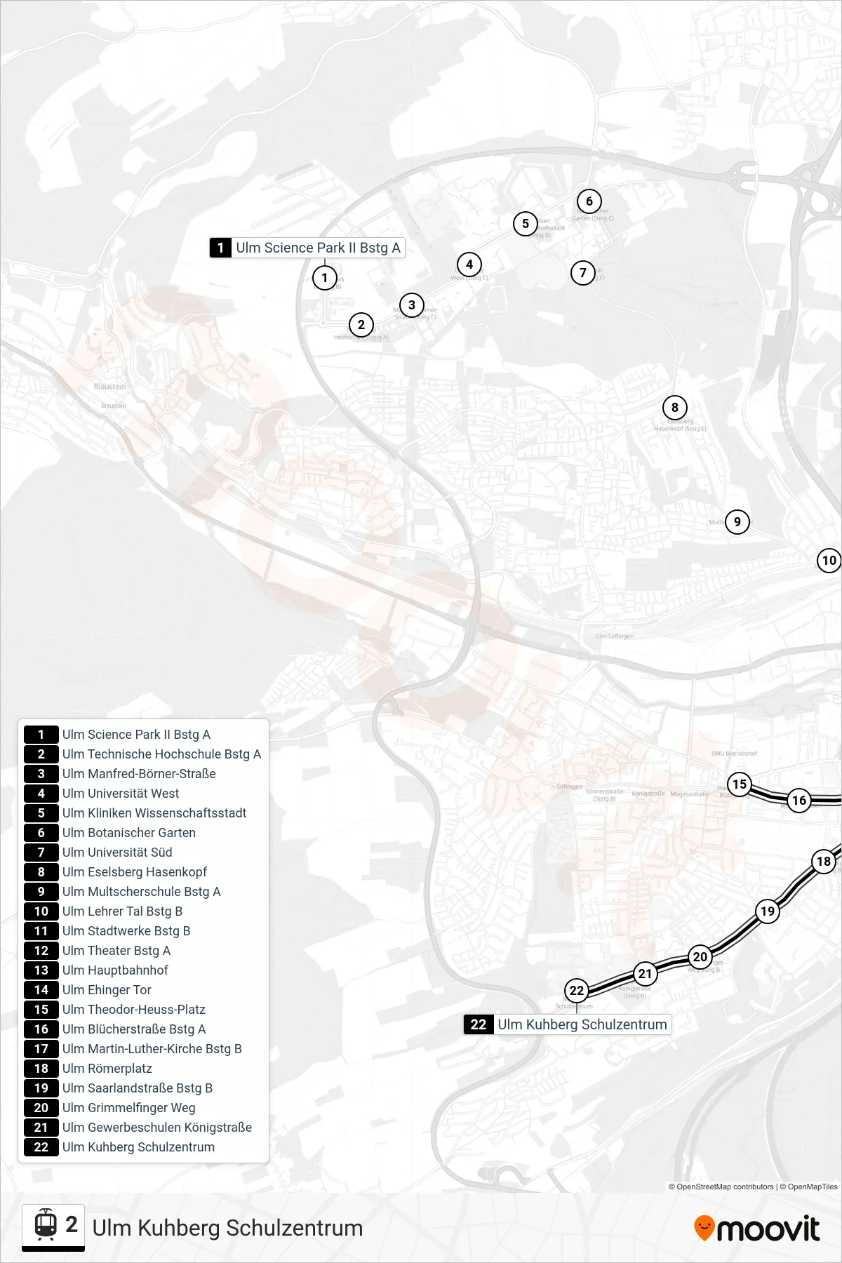
Stops list (2 - Ulm Kuhberg Schulzentrum)
- Ulm Science Park II Bstg A
- Ulm Technische Hochschule Bstg A
- Ulm Manfred-Börner-Straße
- Ulm Universität West
- Ulm Kliniken Wissenschaftsstadt
- Ulm Botanischer Garten
- Ulm Universität Süd
- Ulm Eselsberg Hasenkopf
- Ulm Multscherschule Bstg A
- Ulm Lehrer Tal Bstg B
- Ulm Stadtwerke Bstg B
- Ulm Theater Bstg A
- Ulm Hauptbahnhof
- Ulm Ehinger Tor
- Ulm Theodor-Heuss-Platz
- Ulm Blücherstraße Bstg A
- Ulm Martin-Luther-Kirche Bstg B
- Ulm Römerplatz
- Ulm Saarlandstraße Bstg B
- Ulm Grimmelfinger Weg
- Ulm Gewerbeschulen Königstraße
- Ulm Kuhberg Schulzentrum