
2 Bus Route Map
View the 2 route map and see all 2 stops along the route. The map of 2 shows where the bus travels and the location of each stop, making it easy to understand the entire route at a glance.
Explore Stadtwerke Heilbronn - Verkehrsbetriebe routes on the map and see where Stadtwerke Heilbronn - Verkehrsbetriebe bus services operate. Use the 2 map to find bus stops and see how the 2 connects different areas along its trip.
All 2 stops on the map are displayed in route order, helping you follow the 2 bus from the first stop to the last.
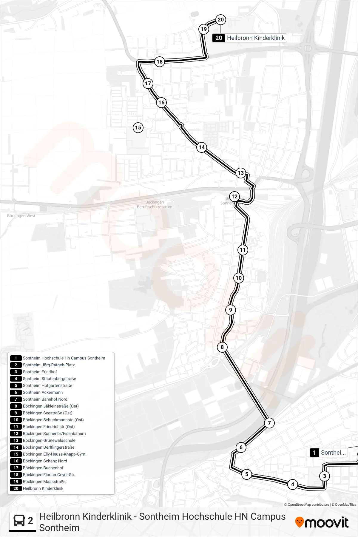
Stops list (2 - Heilbronn Kinderklinik)
- Sontheim Hochschule Hn Campus Sontheim
- Sontheim Jörg-Ratgeb-Platz
- Sontheim Friedhof
- Sontheim Staufenbergstraße
- Sontheim Hofgartenstraße
- Sontheim Ackermann
- Sontheim Bahnhof Nord
- Böckingen Jäkleinstraße (Ost)
- Böckingen Seestraße (Ost)
- Böckingen Schuchmannstr. (Ost)
- Böckingen Friedrichstr (Ost)
- Böckingen Sonnenbr/Eisenbahnm
- Böckingen Grünewaldschule
- Böckingen Derfflingerstraße
- Böckingen Elly-Heuss-Knapp-Gym.
- Böckingen Schanz Nord
- Böckingen Buchenhof
- Böckingen Florian-Geyer-Str.
- Böckingen Maasstraße
- Heilbronn Kinderklinik