
2 Bus Route Map
View the 2 route map and see all 2 stops along the route. The map of 2 shows where the bus travels and the location of each stop, making it easy to understand the entire route at a glance.
Explore Hohenz.Landesbahn GmbH routes on the map and see where Hohenz.Landesbahn GmbH bus services operate. Use the 2 map to find bus stops and see how the 2 connects different areas along its trip.
All 2 stops on the map are displayed in route order, helping you follow the 2 bus from the first stop to the last.
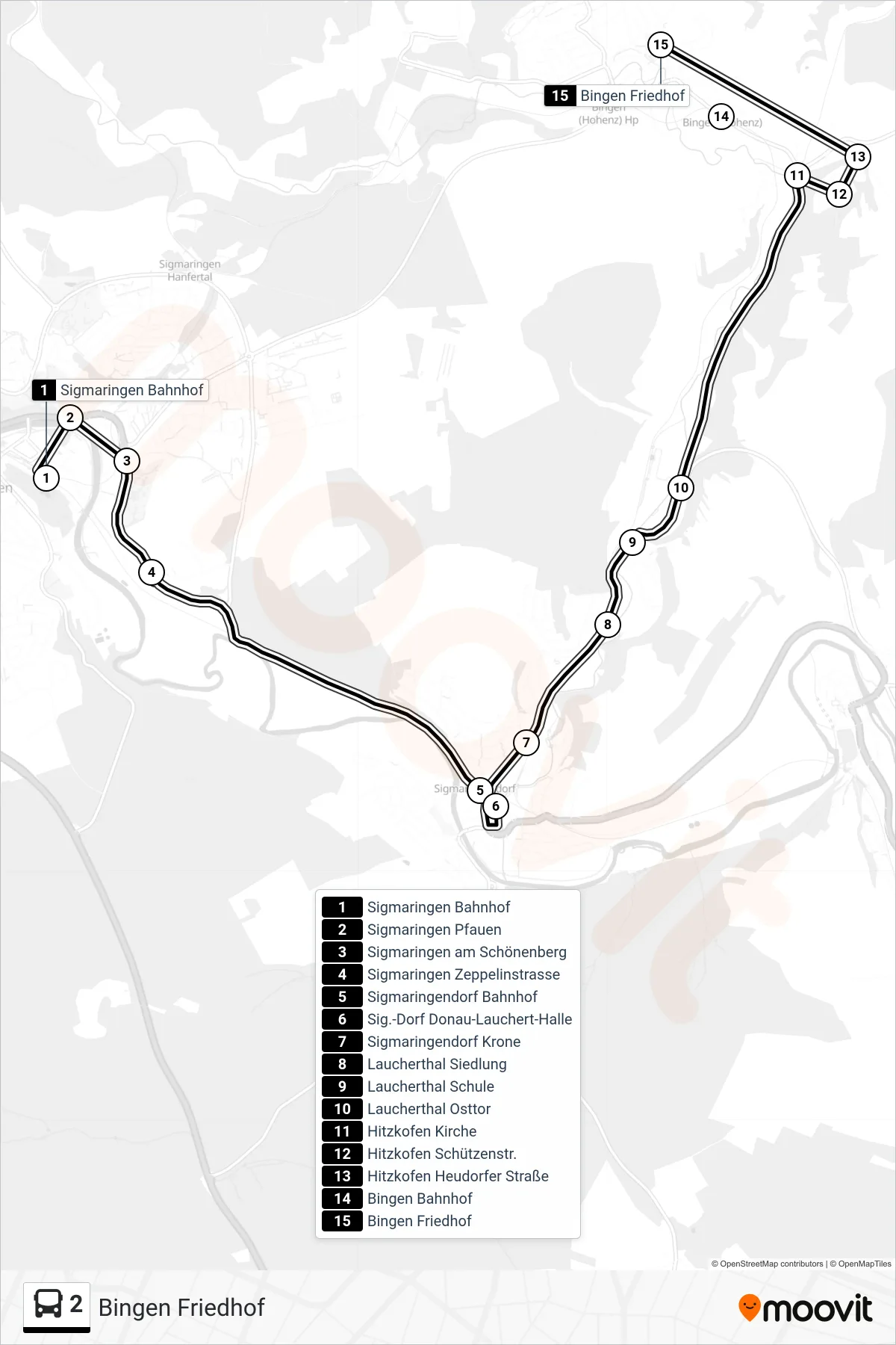
Stops list (2 - Bingen Friedhof)
- Sigmaringen Bahnhof
- Sigmaringen Pfauen
- Sigmaringen am Schönenberg
- Sigmaringen Zeppelinstrasse
- Sigmaringendorf Bahnhof
- Sig.-Dorf Donau-Lauchert-Halle
- Sigmaringendorf Krone
- Laucherthal Siedlung
- Laucherthal Schule
- Laucherthal Osttor
- Hitzkofen Kirche
- Hitzkofen Schützenstr.
- Hitzkofen Heudorfer Straße
- Bingen Bahnhof
- Bingen Friedhof
Change direction
- Route Map - 2 - Bingen Rathaus
- Route Map - 2 - Hornstein Ort
- Route Map - 2 - Bingen Friedhof
- Route Map - 2 - Hitzkofen Schützenstr.
- Route Map - 2 - Sigmaringendorf Bahnhof
- Route Map - 2 - Kettenacker Lusthof
- Route Map - 2 - Inneringen Dullenberg
- Route Map - 2 - Inneringen Volksbank
- Route Map - 2 - Sigmaringen Bilharzschule
- Route Map - 2 - Sigmaringen Bilharzschule
- Route Map - 2 - Bingen Rathaus
- Route Map - 2 - Sig.-Dorf Donau-Lauchert-Halle
- Route Map - 2 - Sigmaringen Hohenzollerngym.
- Route Map - 2 - Hitzkofen Schützenstr.
- Route Map - 2 - Inneringen Kirche
- Route Map - 2 - Gammertingen Bahnhof
- Route Map - 2 - Gammertingen Verb.Wasserw.
- Route Map - 2 - Sigmaringen Bahnhof
- Route Map - 2 - Bingen Elogiusstraße
- Route Map - 2 - Sigmaringen Hanfertal Bhf.
- Route Map - 2 - Hochberg Rathaus
- Route Map - 2 - Inneringen Jahnstr.
- Route Map - 2 - Inneringen Lindenbergstr.
- Route Map - 2 - Sigmaringendorf Bahnhof