
2 Bus Route Map
View the 2 route map and see all 2 stops along the route. The map of 2 shows where the bus travels and the location of each stop, making it easy to understand the entire route at a glance.
Explore RVS routes on the map and see where RVS bus services operate. Use the 2 map to find bus stops and see how the 2 connects different areas along its trip.
All 2 stops on the map are displayed in route order, helping you follow the 2 bus from the first stop to the last.
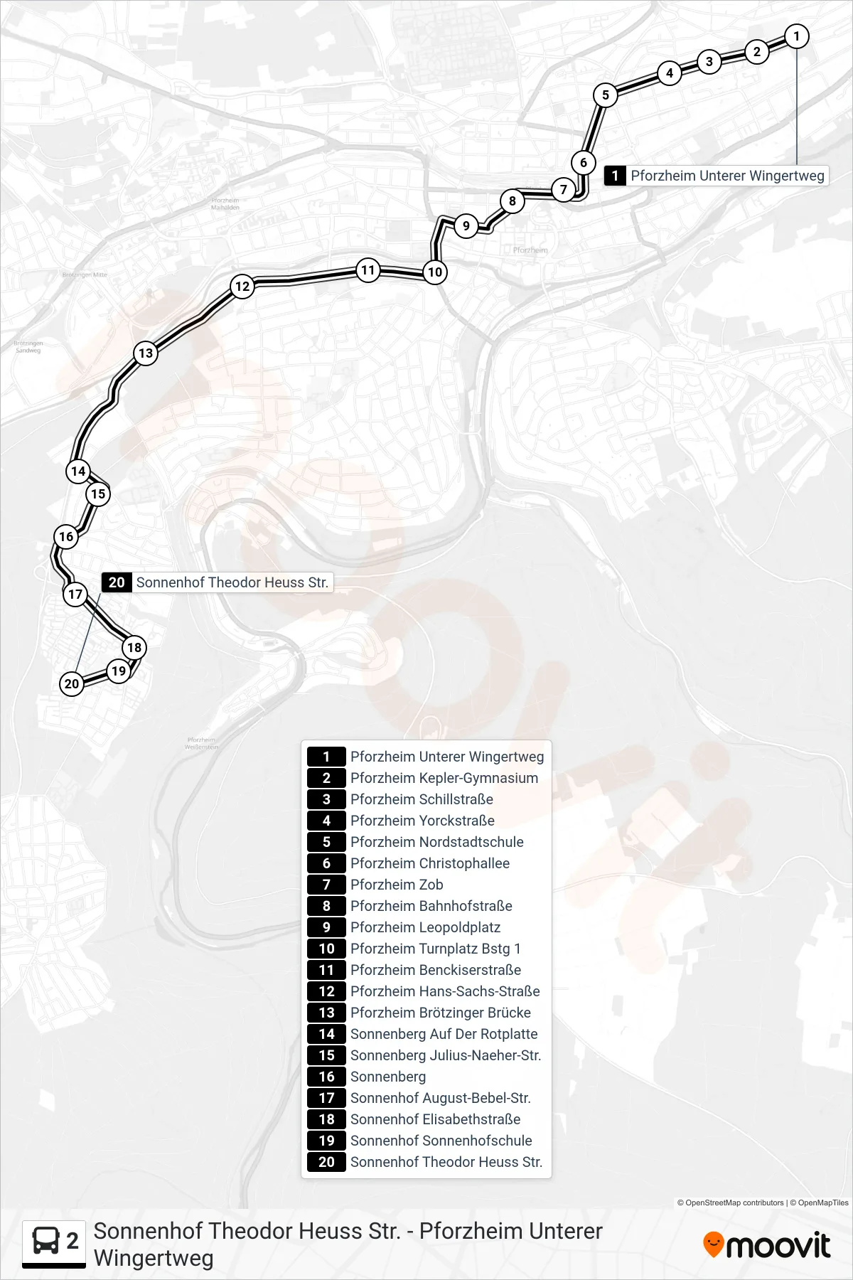
Stops list (2 - Sonnenhof Theodor Heuss Str.)
- Pforzheim Unterer Wingertweg
- Pforzheim Kepler-Gymnasium
- Pforzheim Schillstraße
- Pforzheim Yorckstraße
- Pforzheim Nordstadtschule
- Pforzheim Christophallee
- Pforzheim Zob
- Pforzheim Bahnhofstraße
- Pforzheim Leopoldplatz
- Pforzheim Turnplatz Bstg 1
- Pforzheim Benckiserstraße
- Pforzheim Hans-Sachs-Straße
- Pforzheim Brötzinger Brücke
- Sonnenberg Auf Der Rotplatte
- Sonnenberg Julius-Naeher-Str.
- Sonnenberg
- Sonnenhof August-Bebel-Str.
- Sonnenhof Elisabethstraße
- Sonnenhof Sonnenhofschule
- Sonnenhof Theodor Heuss Str.