
2 Tram Route Map
View the 2 route map and see all 2 stops along the route. The map of 2 shows where the tram travels and the location of each stop, making it easy to understand the entire route at a glance.
Explore routes on the map and see where tram services operate. Use the 2 map to find tram stations and see how the 2 connects different areas along its trip.
All 2 stops on the map are displayed in route order, helping you follow the 2 tram from the first station to the last.
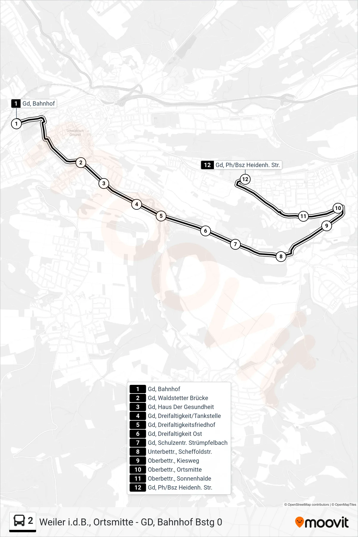
Stops list (2 - Gd, Ph/Bsz Heidenh. Str.)
- Gd, Bahnhof
- Gd, Waldstetter Brücke
- Gd, Haus Der Gesundheit
- Gd, Dreifaltigkeit/Tankstelle
- Gd, Dreifaltigkeitsfriedhof
- Gd, Dreifaltigkeit Ost
- Gd, Schulzentr. Strümpfelbach
- Unterbettr., Scheffoldstr.
- Oberbettr., Kiesweg
- Oberbettr., Ortsmitte
- Oberbettr., Sonnenhalde
- Gd, Ph/Bsz Heidenh. Str.
Change direction
- Route Map - 2 - Gd, Ph/Bsz Oberbettr. Str.
- Route Map - 2 - Degenfeld, Nenninger Weg
- Route Map - 2 - Hornberg
- Route Map - 2 - Lindenfeld, Hochhaus
- Route Map - 2 - Weiler I.D.B., Ortsmitte
- Route Map - 2 - Lindenfeld, Lindeneck
- Route Map - 2 - Gd, Schulzentr. Strümpfelbach
- Route Map - 2 - Gd, Lindenhof
- Route Map - 2 - Heubach, Triumph
- Route Map - 2 - Gd, Bahnhof
- Route Map - 2 - Lindenfeld, Kirchäcker
- Route Map - 2 - Lindenfeld, Lindenhofstraße
- Route Map - 2 - Weißenstein Altes Rathaus