
2 Bus Route Map
View the 2 route map and see all 2 stops along the route. The map of 2 shows where the bus travels and the location of each stop, making it easy to understand the entire route at a glance.
Explore GTT Urban Service routes on the map and see where GTT Urban Service bus services operate. Use the 2 map to find bus stops and see how the 2 connects different areas along its trip.
All 2 stops on the map are displayed in route order, helping you follow the 2 bus from the first stop to the last.
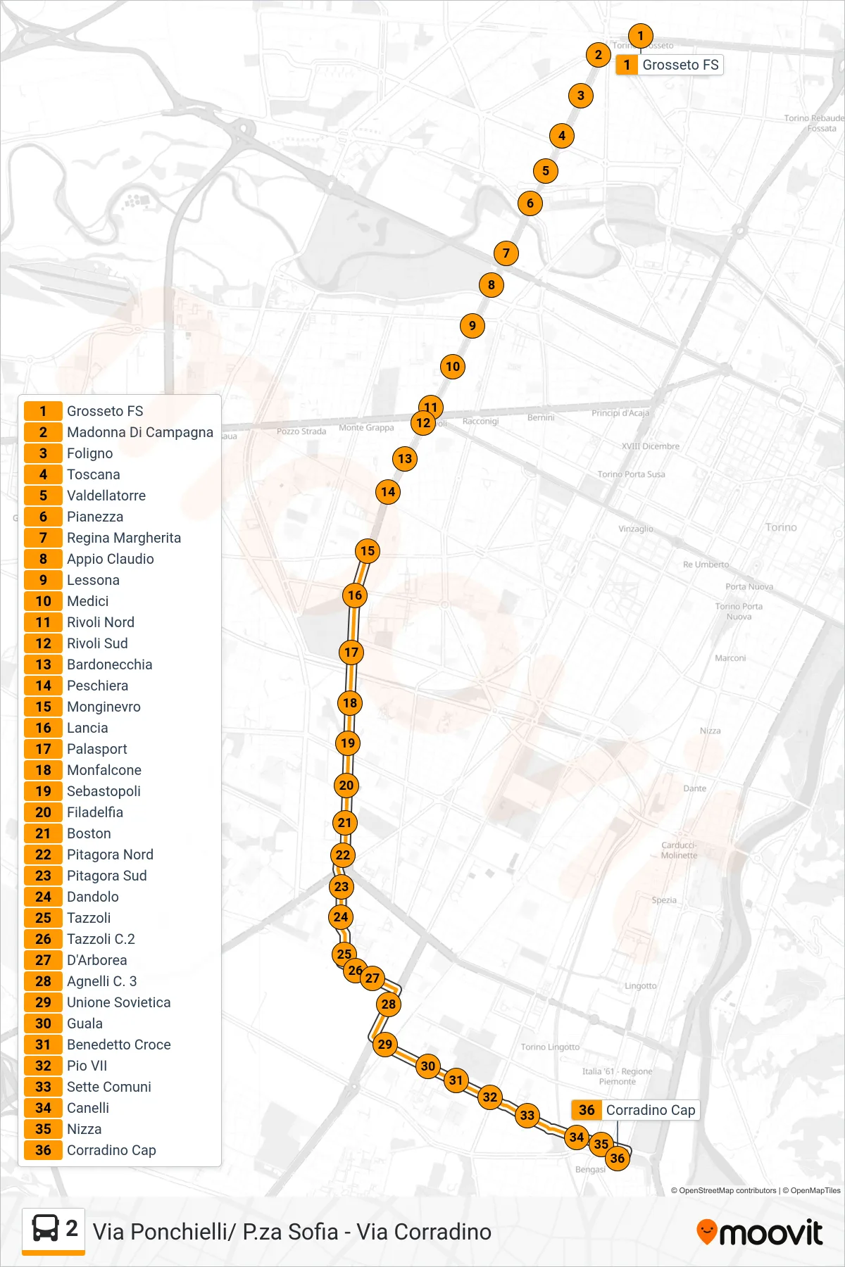
Stops list (2 - Corradino)
- Sofia Terminal
- Sofia
- Pergolesi
- Paroletti
- Croce Rossa
- Bologna
- Cimarosa East
- Ponchielli Stop
- Cimarosa
- Croce Rossa
- Bologna
- Corelli
- Giovanni Bosco Hospital
- Julius Caesar
- Derna South
- Rebaudengo
- Ala Di Stura
- Church of the Salute
- Roccavione
- Casteldelfino
- Grosseto FS
- Madonna of Countryside
- Foligno
- Toscana
- Valdellatorre
- Pianezza
- Queen Margherita
- Appio Claudio
- Lessona
- Medici
- Rivoli North
- South Rivoli
- Bardonecchia
- Peschiera
- Montgenevre
- Lancia
- Sports Hall
- Monfalcone
- Sebastopoli
- Filadelfia
- Boston
- Pitagora North
- Pitagora South
- Dandolo
- Tazzoli
- Tazzoli C.2
- D'Arborea
- Agnelli C. 3
- Soviet Union
- Guala
- Benedetto Croce
- Pio VII
- Seven Commons
- Canelli
- Nice
- Corradino Cap