
2 Bus Route Map
View the 2 route map and see all 2 stops along the route. The map of 2 shows where the bus travels and the location of each stop, making it easy to understand the entire route at a glance.
Explore Asp Asti routes on the map and see where Asp Asti bus services operate. Use the 2 map to find bus stops and see how the 2 connects different areas along its trip.
All 2 stops on the map are displayed in route order, helping you follow the 2 bus from the first stop to the last.
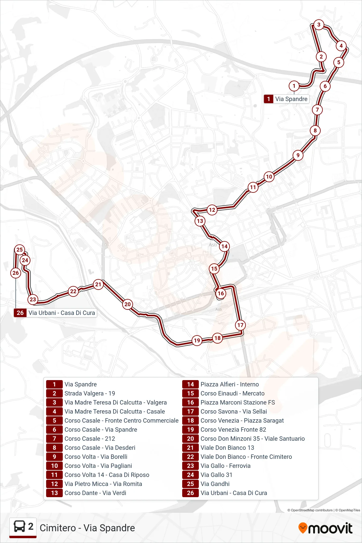
Stops list (2 - Urbani Street - Cemetery Area)
- Via Spandre
- Valgera Road - 19
- Mother Teresa of Calcutta Street - Valgera
- Mother Teresa of Calcutta Street - Casale
- Casale Avenue - Opposite Shopping Center
- Casale Avenue - Spandre Street
- Corso Casale - 212
- Casale Avenue - Desderi Street
- Corso Volta - Borelli Street
- Volta Course - Pagliani Street
- Corso Volta 14 - Rest Home
- Pietro Micca Street - Romita Street
- Dante Avenue - Verdi Street
- Alfieri Square - Interior
- Corso Einaudi - Market
- Marconi Square FS Station
- Corso Savona - Via Sellai
- Venice Course - Saragat Square
- Corso Venezia Front 82
- Corso Don Minzoni 35 - Sanctuary Avenue
- Don Bianco Avenue 13
- Don Bianco Avenue - Opposite Cemetery
- Gallo Street - Railway
- Via Gallo 31
- Gandhi Street
- Urbani Street - Nursing Home