
2 Bus Route Map
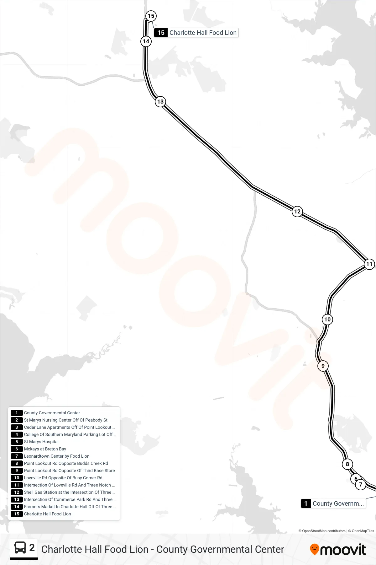
View the 2 route map and see all 2 stops along the route. The map of 2 shows where the bus travels and the location of each stop, making it easy to understand the entire route at a glance.
Explore St. Mary's Transit System routes on the map and see where St. Mary's Transit System bus services operate. Use the 2 map to find bus stops and see how the 2 connects different areas along its trip.
All 2 stops on the map are displayed in route order, helping you follow the 2 bus from the first stop to the last.
Stops list (2 - Charlotte Hall Food Lion)
- County Governmental Center
- St Marys Nursing Center Off Of Peabody St
- Cedar Lane Apartments Off Of Point Lookout Rd
- College Of Southern Maryland Parking Lot Off Of Point Lookout Rd
- St Marys Hospital
- Mckays at Breton Bay
- Leonardtown Center by Food Lion
- Point Lookout Rd Opposite Budds Creek Rd
- Point Lookout Rd Opposite Of Third Base Store
- Loveville Rd Opposite Of Busy Corner Rd
- Intersection Of Loveville Rd And Three Notch Rd on the South Side Of Loveville Rd
- Shell Gas Station at the Intersection Of Three Notch And New Market Turner Rd
- Intersection Of Commerce Park Rd And Three Notch Rd
- Farmers Market In Charlotte Hall Off Of Three Notch Rd
- Charlotte Hall Food Lion