
2 Light Rail Route Map
View the 2 route map and see all 2 stops along the route. The map of 2 shows where the light rail travels and the location of each stop, making it easy to understand the entire route at a glance.
Explore IVB und Stubaitalbahn GmbH routes on the map and see where IVB und Stubaitalbahn GmbH light rail services operate. Use the 2 map to find light rail stations and see how the 2 connects different areas along its trip.
All 2 stops on the map are displayed in route order, helping you follow the 2 light rail from the first station to the last.
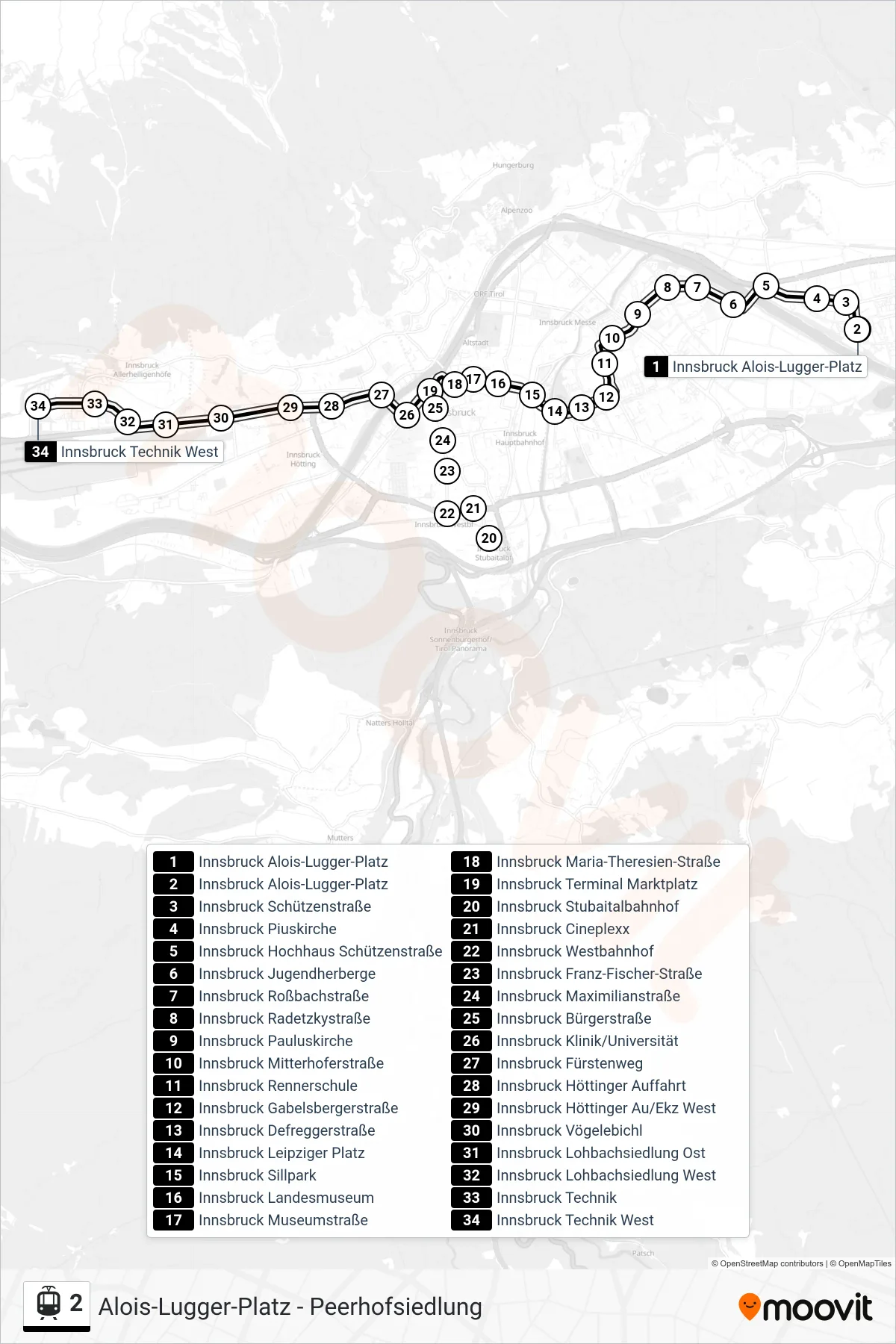
Stops list (2 - Innsbruck Technik West)
- Innsbruck Alois-Lugger-Platz
- Innsbruck Alois-Lugger-Platz
- Innsbruck Schützenstraße
- Innsbruck Piuskirche
- Innsbruck Hochhaus Schützenstraße
- Innsbruck Jugendherberge
- Innsbruck Roßbachstraße
- Innsbruck Radetzkystraße
- Innsbruck Pauluskirche
- Innsbruck Mitterhoferstraße
- Innsbruck Rennerschule
- Innsbruck Gabelsbergerstraße
- Innsbruck Defreggerstraße
- Innsbruck Leipziger Platz
- Innsbruck Sillpark
- Innsbruck Landesmuseum
- Innsbruck Museumstraße
- Innsbruck Maria-Theresien-Straße
- Innsbruck Terminal Marktplatz
- Innsbruck Stubaitalbahnhof
- Innsbruck Cineplexx
- Innsbruck Westbahnhof
- Innsbruck Franz-Fischer-Straße
- Innsbruck Maximilianstraße
- Innsbruck Bürgerstraße
- Innsbruck Klinik/Universität
- Innsbruck Fürstenweg
- Innsbruck Höttinger Auffahrt
- Innsbruck Höttinger Au/Ekz West
- Innsbruck Vögelebichl
- Innsbruck Lohbachsiedlung Ost
- Innsbruck Lohbachsiedlung West
- Innsbruck Technik
- Innsbruck Technik West