
2 Tram Route Map
View the 2 route map and see all 2 stops along the route. The map of 2 shows where the tram travels and the location of each stop, making it easy to understand the entire route at a glance.
Explore routes on the map and see where tram services operate. Use the 2 map to find tram stations and see how the 2 connects different areas along its trip.
All 2 stops on the map are displayed in route order, helping you follow the 2 tram from the first station to the last.
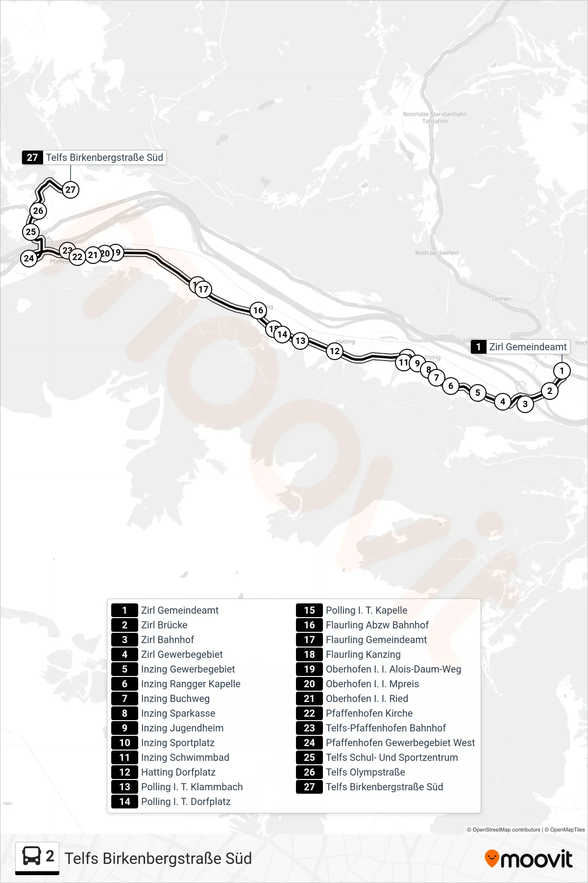
Stops list (2 - Telfs Birkenbergstraße Süd)
- Zirl Gemeindeamt
- Zirl Brücke
- Zirl Bahnhof
- Zirl Gewerbegebiet
- Inzing Gewerbegebiet
- Inzing Rangger Kapelle
- Inzing Buchweg
- Inzing Sparkasse
- Inzing Jugendheim
- Inzing Sportplatz
- Inzing Schwimmbad
- Hatting Dorfplatz
- Polling I. T. Klammbach
- Polling I. T. Dorfplatz
- Polling I. T. Kapelle
- Flaurling Abzw Bahnhof
- Flaurling Gemeindeamt
- Flaurling Kanzing
- Oberhofen I. I. Alois-Daum-Weg
- Oberhofen I. I. Mpreis
- Oberhofen I. I. Ried
- Pfaffenhofen Kirche
- Telfs-Pfaffenhofen Bahnhof
- Pfaffenhofen Gewerbegebiet West
- Telfs Schul- Und Sportzentrum
- Telfs Olympstraße
- Telfs Birkenbergstraße Süd
Change direction
- Route Map - 2 - Inzing Schwimmbad
- Route Map - 2 - Zirl Bahnhof
- Route Map - 2 - Telfs Olympstraße
- Route Map - 2 - Flaurling Abzw Bahnhof
- Route Map - 2 - Inzing Schwimmbad
- Route Map - 2 - Oberhofen I. I. Gasse
- Route Map - 2 - Zirl Bahnhof
- Route Map - 2 - Telfs-Pfaffenhofen Bahnhof
- Route Map - 2 - Telfs Anton-Auer-Straße
- Route Map - 2 - Flaurling Kanzing
- Route Map - 2 - Telfs Schul- Und Sportzentrum
- Route Map - 2 - Zirl Gemeindeamt
- Route Map - 2 - Flaurling Abzw Bahnhof