
2 Bus Route Map
View the 2 route map and see all 2 stops along the route. The map of 2 shows where the bus travels and the location of each stop, making it easy to understand the entire route at a glance.
Explore Yuma County Intergovernmental Public Transportation Authority routes on the map and see where Yuma County Intergovernmental Public Transportation Authority bus services operate. Use the 2 map to find bus stops and see how the 2 connects different areas along its trip.
All 2 stops on the map are displayed in route order, helping you follow the 2 bus from the first stop to the last.
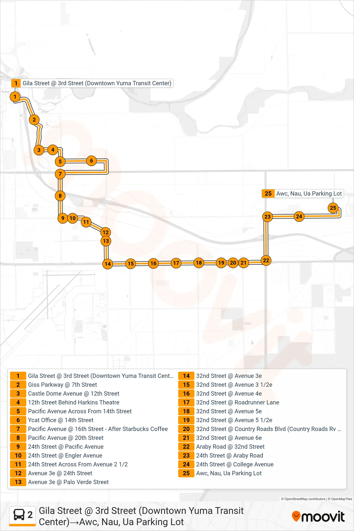
Stops list (2 - Gila Street @ 3rd Street (Downtown Yuma Transit Center)→Awc, Nau, Ua Parking Lot)
- Gila Street @ 3rd Street (Downtown Yuma Transit Center)
- Giss Parkway @ 7th Street
- Castle Dome Avenue @ 12th Street
- 12th Street Behind Harkins Theatre
- Pacific Avenue Across From 14th Street
- Ycat Office @ 14th Street
- Pacific Avenue @ 16th Street - After Starbucks Coffee
- Pacific Avenue @ 20th Street
- 24th Street @ Pacific Avenue
- 24th Street @ Engler Avenue
- 24th Street Across From Avenue 2 1/2
- Avenue 3e @ 24th Street
- Avenue 3e @ Palo Verde Street
- 32nd Street @ Avenue 3e
- 32nd Street @ Avenue 3 1/2e
- 32nd Street @ Avenue 4e
- 32nd Street @ Roadrunner Lane
- 32nd Street @ Avenue 5e
- 32nd Street @ Avenue 5 1/2e
- 32nd Street @ Country Roads Blvd (Country Roads Rv Park)
- 32nd Street @ Avenue 6e
- Araby Road @ 32nd Street
- 24th Street @ Araby Road
- 24th Street @ College Avenue
- Awc, Nau, Ua Parking Lot
Change direction
- Route Map - 2 - Awc, Nau, Ua Parking Lot→3rd Street @ Gila Street (Downtown Yuma Transit Center)
- Route Map - 2 - 16th Street In Front Of Panda Express→3rd Street @ Gila Street (Downtown Yuma Transit Center)
- Route Map - 2 - Castle Dome Avenue @ Yuma Palms Parkway→3rd Street @ Gila Street (Downtown Yuma Transit Center)
- Route Map - 2 - Gila Street @ 3rd Street (Downtown Yuma Transit Center)→12th Street Behind Harkins Theatre