
20 Bus Route Map
View the 20 route map and see all 20 stops along the route. The map of 20 shows where the bus travels and the location of each stop, making it easy to understand the entire route at a glance.
Explore Athens Clarke County Transit routes on the map and see where Athens Clarke County Transit bus services operate. Use the 20 map to find bus stops and see how the 20 connects different areas along its trip.
All 20 stops on the map are displayed in route order, helping you follow the 20 bus from the first stop to the last.
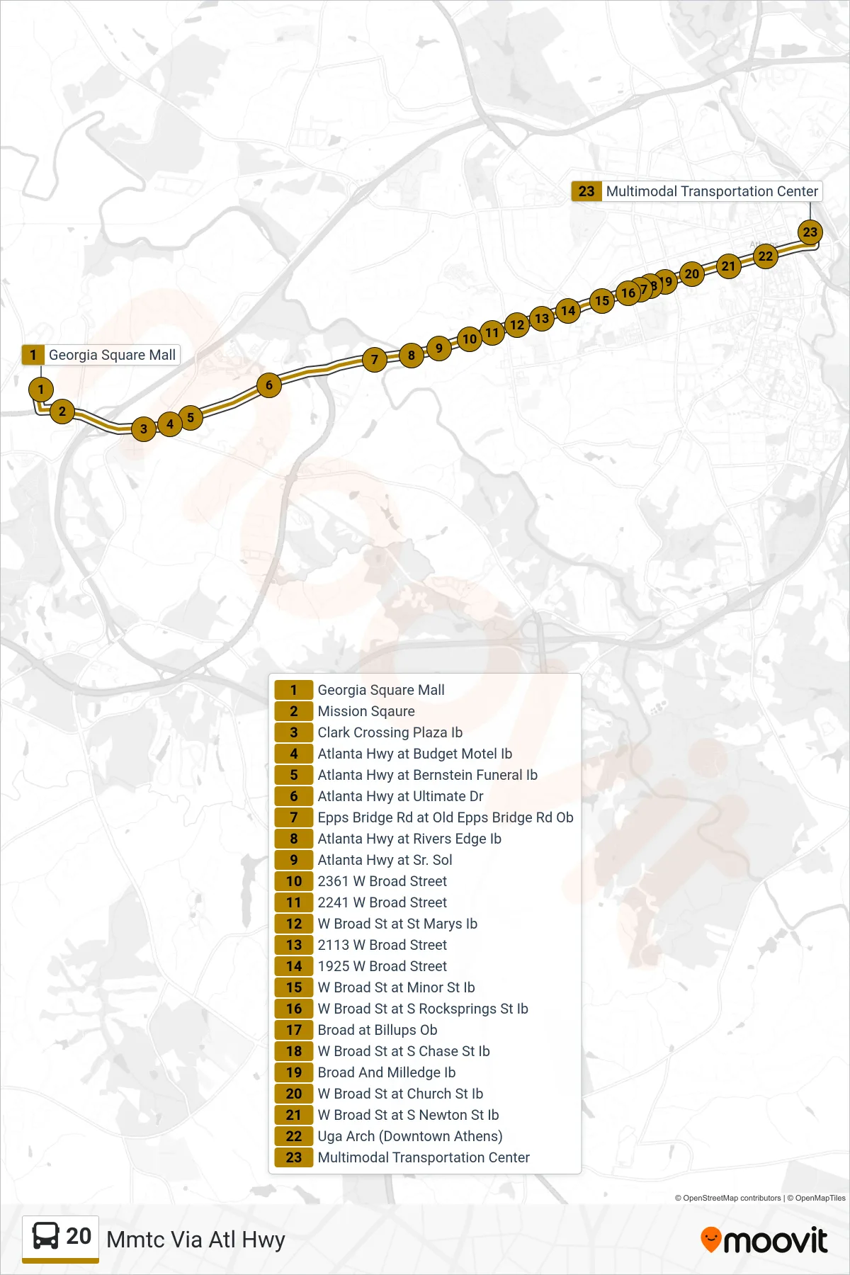
Stops list (20 - Mmtc Via Atl Hwy)
- Georgia Square Mall
- Mission Sqaure
- Clark Crossing Plaza Ib
- Atlanta Hwy at Budget Motel Ib
- Atlanta Hwy at Bernstein Funeral Ib
- Atlanta Hwy at Ultimate Dr
- Epps Bridge Rd at Old Epps Bridge Rd Ob
- Atlanta Hwy at Rivers Edge Ib
- Atlanta Hwy at Sr. Sol
- 2361 W Broad Street
- 2241 W Broad Street
- W Broad St at St Marys Ib
- 2113 W Broad Street
- 1925 W Broad Street
- W Broad St at Minor St Ib
- W Broad St at S Rocksprings St Ib
- Broad at Billups Ob
- W Broad St at S Chase St Ib
- Broad And Milledge Ib
- W Broad St at Church St Ib
- W Broad St at S Newton St Ib
- Uga Arch (Downtown Athens)
- Multimodal Transportation Center