
20 Bus Route Map
View the 20 route map and see all 20 stops along the route. The map of 20 shows where the bus travels and the location of each stop, making it easy to understand the entire route at a glance.
Explore De Lijn routes on the map and see where De Lijn bus services operate. Use the 20 map to find bus stops and see how the 20 connects different areas along its trip.
All 20 stops on the map are displayed in route order, helping you follow the 20 bus from the first stop to the last.
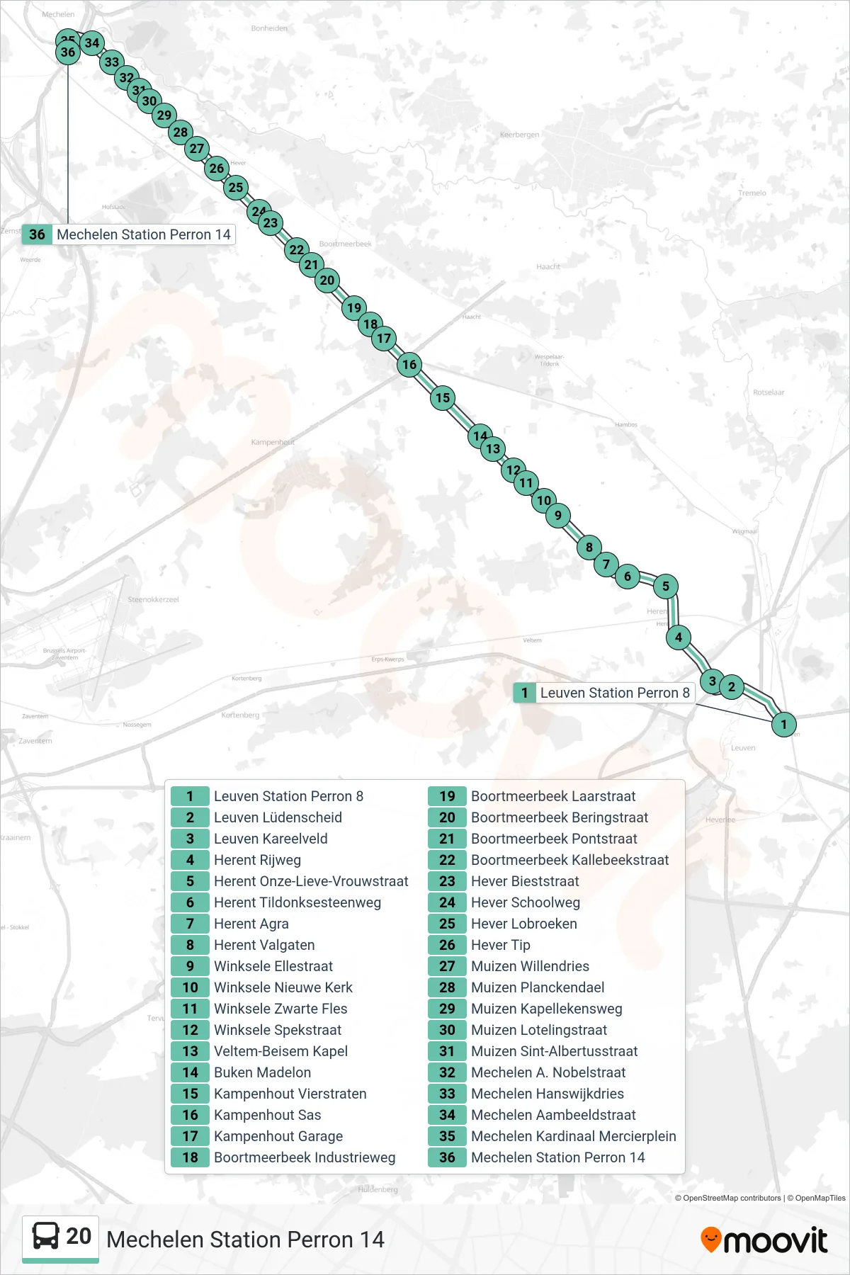
Stops list (20 - Mechelen Station Platform 14)
- Leuven Station Platform 8
- Leuven Lüdenscheid
- Leuven Brick Field
- Herent Road
- Herent Our Lady Street
- Herent Tildonk Road
- Herent Agra
- Herent Valgaten
- Winksele Elle Street
- Winksele New Church
- Winksele Black Bottle
- Winksele Bacon Street
- Veltem-Beisem Chapel
- Buken Madelon
- Kampenhout Four Streets
- Kampenhout Lock
- Kampenhout Garage
- Boortmeerbeek Industrial Way
- Boortmeerbeek Boot Street
- Boortmeerbeek Bering Street
- Boortmeerbeek Pont Street
- Boortmeerbeek Kallebeek Street
- Hever Biest Street
- Hever School Way
- Hever Lobroeken
- Hever Tip
- Muizen Willendries
- Muizen Planckendael
- Muizen Chapel Way
- Muizen Loteling Street
- Muizen St. Albertus Street
- Mechelen A. Nobel Street
- Mechelen Hanswijk Square
- Mechelen Anvil Street
- Mechelen Cardinal Mercier Square
- Mechelen Station Platform 14