
20 Bus Route Map
View the 20 route map and see all 20 stops along the route. The map of 20 shows where the bus travels and the location of each stop, making it easy to understand the entire route at a glance.
Explore KP Kyivpastrans routes on the map and see where KP Kyivpastrans bus services operate. Use the 20 map to find bus stops and see how the 20 connects different areas along its trip.
All 20 stops on the map are displayed in route order, helping you follow the 20 bus from the first stop to the last.
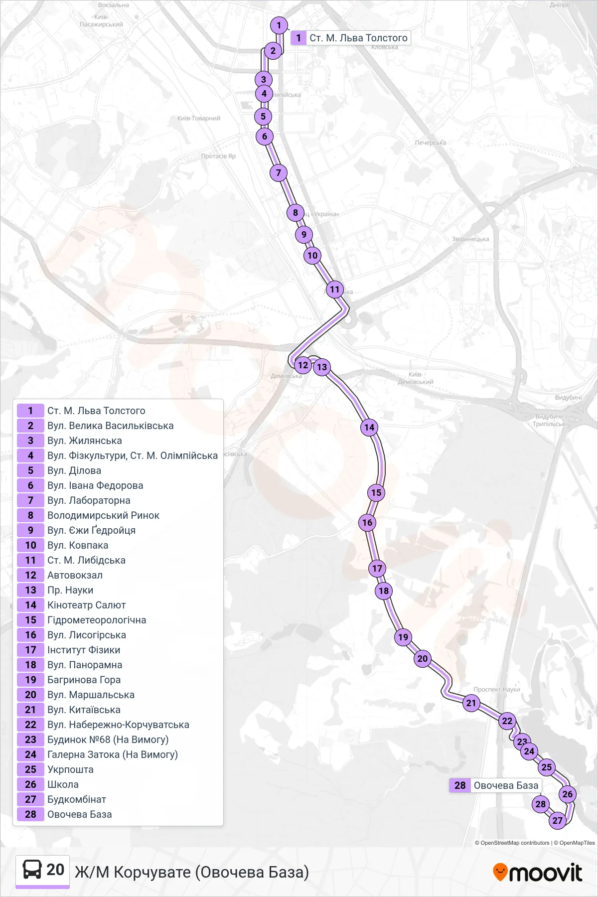
Stops list (20 - Korchuvate District (Vegetable Base))
- Lev Tolstoy Metro Station
- Velyka Vasylkivska St
- Zhylianska St
- Fizkultury Street, Olimpiiska Metro Station
- Dilova Street
- Ivana Fedorova Street
- Laboratory Street
- Volodymyrskyi Market
- Jerzy Giedroyc Street
- Kovpaka Street
- Lybidska Metro Station
- Bus Station
- Science Avenue
- Salut Cinema
- Hydrometeorolohichna
- Lysohirska Street
- Institute of Physics
- Panoramna Street
- Bahrynova Mountain
- Marshalska Street
- Kytaivska St.
- Naberezhno-Korchuvatska Street
- Building #68 (On Request)
- Halerna Bay (On Demand)
- Ukrposhta
- School
- Construction Plant
- Vegetable Warehouse