
20 Bus Route Map
View the 20 route map and see all 20 stops along the route. The map of 20 shows where the bus travels and the location of each stop, making it easy to understand the entire route at a glance.
Explore Red Rose Transit Authority routes on the map and see where Red Rose Transit Authority bus services operate. Use the 20 map to find bus stops and see how the 20 connects different areas along its trip.
All 20 stops on the map are displayed in route order, helping you follow the 20 bus from the first stop to the last.
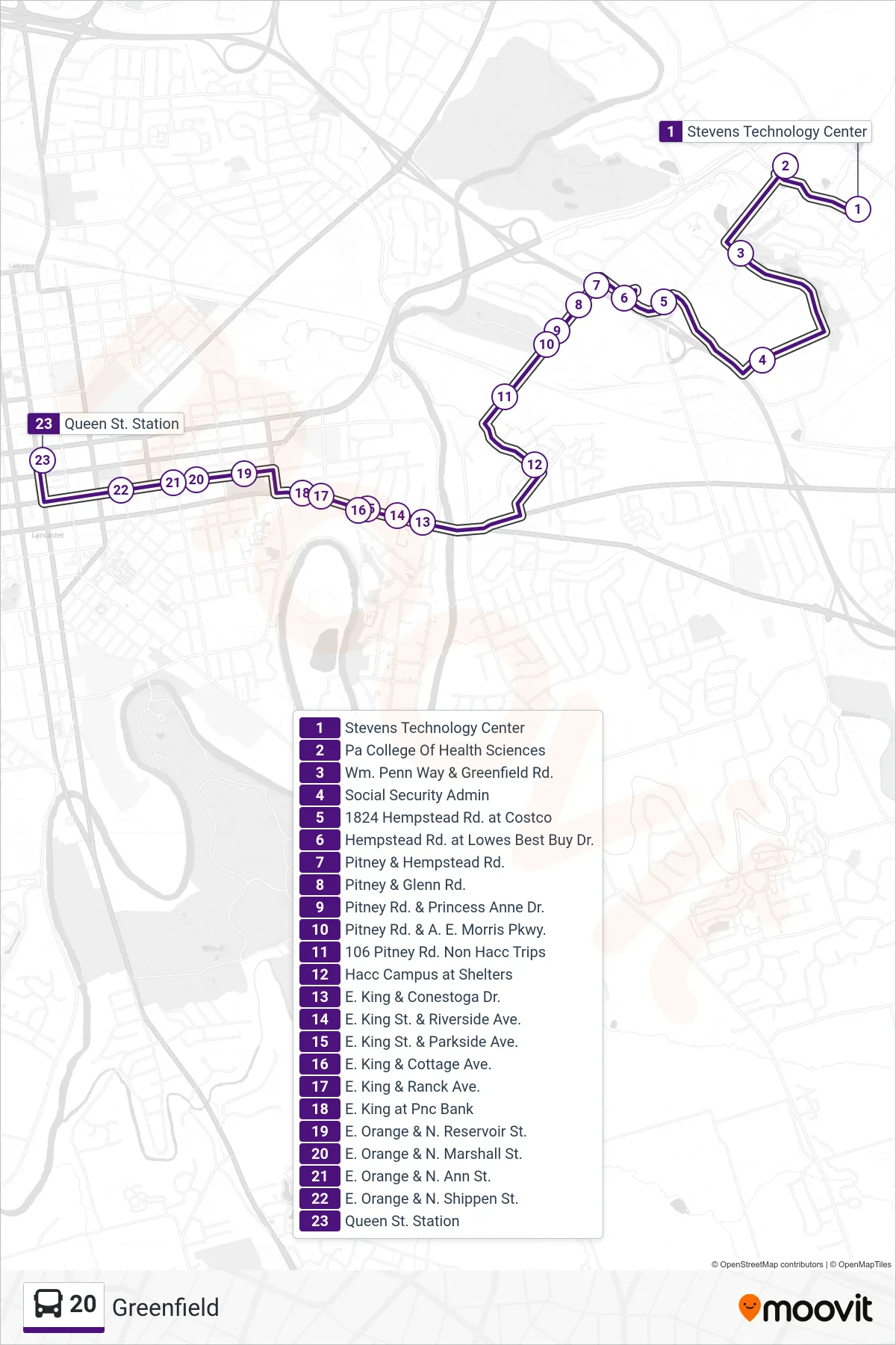
Stops list (20 - Queen Street Station)
- Stevens Technology Center
- Pa College Of Health Sciences
- Wm. Penn Way & Greenfield Rd.
- Social Security Admin
- 1824 Hempstead Rd. at Costco
- Hempstead Rd. at Lowes Best Buy Dr.
- Pitney & Hempstead Rd.
- Pitney & Glenn Rd.
- Pitney Rd. & Princess Anne Dr.
- Pitney Rd. & A. E. Morris Pkwy.
- 106 Pitney Rd. Non Hacc Trips
- Hacc Campus at Shelters
- E. King & Conestoga Dr.
- E. King St. & Riverside Ave.
- E. King St. & Parkside Ave.
- E. King & Cottage Ave.
- E. King & Ranck Ave.
- E. King at Pnc Bank
- E. Orange & N. Reservoir St.
- E. Orange & N. Marshall St.
- E. Orange & N. Ann St.
- E. Orange & N. Shippen St.
- Queen St. Station