
20 Bus Route Map
View the 20 route map and see all 20 stops along the route. The map of 20 shows where the bus travels and the location of each stop, making it easy to understand the entire route at a glance.
Explore LNG Fulda routes on the map and see where LNG Fulda bus services operate. Use the 20 map to find bus stops and see how the 20 connects different areas along its trip.
All 20 stops on the map are displayed in route order, helping you follow the 20 bus from the first stop to the last.
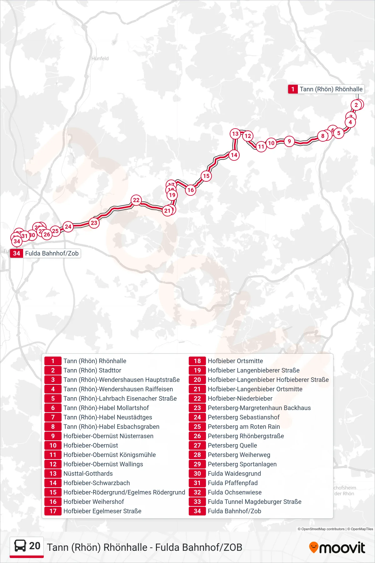
Stops list (20 - Fulda Bahnhof/Zob)
- Tann (Rhön) Rhönhalle
- Tann (Rhön) Stadttor
- Tann (Rhön)-Wendershausen Hauptstraße
- Tann (Rhön)-Wendershausen Raiffeisen
- Tann (Rhön)-Lahrbach Eisenacher Straße
- Tann (Rhön)-Habel Mollartshof
- Tann (Rhön)-Habel Neustädtges
- Tann (Rhön)-Habel Esbachsgraben
- Hofbieber-Obernüst Nüsterrasen
- Hofbieber-Obernüst
- Hofbieber-Obernüst Königsmühle
- Hofbieber-Obernüst Wallings
- Nüsttal-Gotthards
- Hofbieber-Schwarzbach
- Hofbieber-Rödergrund/Egelmes Rödergrund
- Hofbieber Weihershof
- Hofbieber Egelmeser Straße
- Hofbieber Ortsmitte
- Hofbieber Langenbieberer Straße
- Hofbieber-Langenbieber Hofbieberer Straße
- Hofbieber-Langenbieber Ortsmitte
- Hofbieber-Niederbieber
- Petersberg-Margretenhaun Backhaus
- Petersberg Sebastianshof
- Petersberg am Roten Rain
- Petersberg Rhönbergstraße
- Petersberg Quelle
- Petersberg Weiherweg
- Petersberg Sportanlagen
- Fulda Waidesgrund
- Fulda Pfaffenpfad
- Fulda Ochsenwiese
- Fulda Tunnel Magdeburger Straße
- Fulda Bahnhof/Zob