
20 Bus Route Map
View the 20 route map and see all 20 stops along the route. The map of 20 shows where the bus travels and the location of each stop, making it easy to understand the entire route at a glance.
Explore LYNX Transit routes on the map and see where LYNX Transit bus services operate. Use the 20 map to find bus stops and see how the 20 connects different areas along its trip.
All 20 stops on the map are displayed in route order, helping you follow the 20 bus from the first stop to the last.
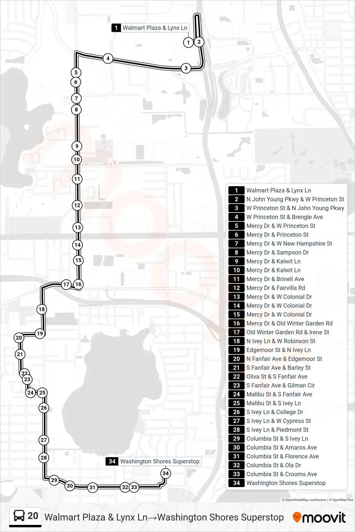
Stops list (20 - Walmart Plaza & Lynx Ln→Washington Shores Superstop)
- Walmart Plaza & Lynx Ln
- N John Young Pkwy & W Princeton St
- W Princeton St & N John Young Pkwy
- W Princeton St & Brengle Ave
- Mercy Dr & W Princeton St
- Mercy Dr & Princeton St
- Mercy Dr & W New Hampshire St
- Mercy Dr & Sampson Dr
- Mercy Dr & Kalwit Ln
- Mercy Dr & Kalwit Ln
- Mercy Dr & Brinell Ave
- Mercy Dr & Fairvilla Rd
- Mercy Dr & W Colonial Dr
- Mercy Dr & W Colonial Dr
- Mercy Dr & W Colonial Dr
- Mercy Dr & Old Winter Garden Rd
- Old Winter Garden Rd & Irene St
- N Ivey Ln & W Robinson St
- Edgemoor St & N Ivey Ln
- N Fanfair Ave & Edgemoor St
- S Fanfair Ave & Barley St
- Oliva St & S Fanfair Ave
- S Fanfair Ave & Gilman Cir
- Malibu St & S Fanfair Ave
- Malibu St & S Ivey Ln
- S Ivey Ln & College Dr
- S Ivey Ln & W Cypress St
- S Ivey Ln & Piedmont St
- Columbia St & S Ivey Ln
- Columbia St & Amaros Ave
- Columbia St & Florence Ave
- Columbia St & Ola Dr
- Columbia St & Crooms Ave
- Washington Shores Superstop