
20 Bus Route Map
View the 20 route map and see all 20 stops along the route. The map of 20 shows where the bus travels and the location of each stop, making it easy to understand the entire route at a glance.
Explore Rīgas satiksme routes on the map and see where Rīgas satiksme bus services operate. Use the 20 map to find bus stops and see how the 20 connects different areas along its trip.
All 20 stops on the map are displayed in route order, helping you follow the 20 bus from the first stop to the last.
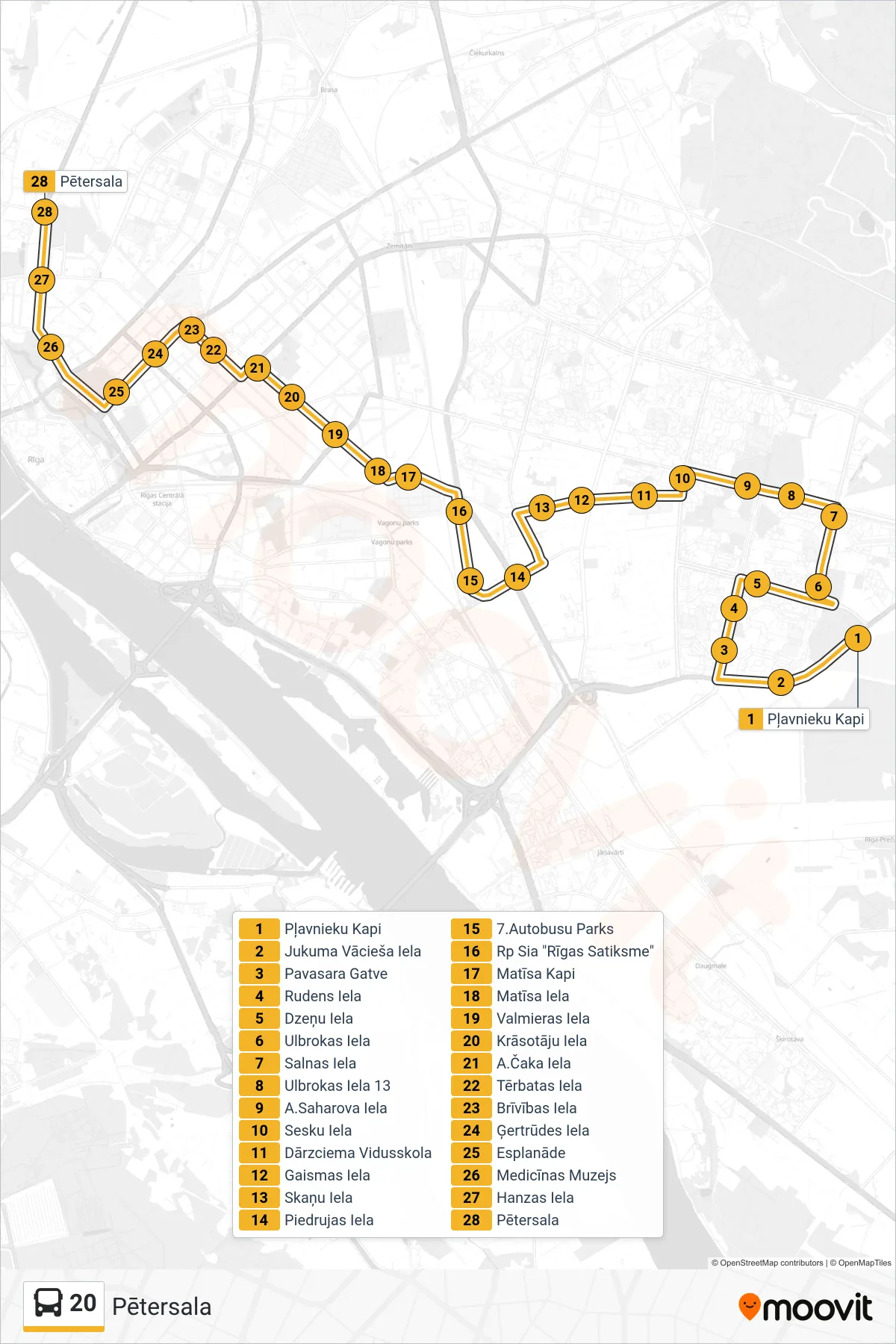
Stops list (20 - Pētersala)
- Pļavnieku Kapi
- Jukuma Vācieša Iela
- Pavasara Gatve
- Rudens Iela
- Dzeņu Iela
- Ulbrokas Iela
- Salnas Iela
- Ulbrokas Iela 13
- A.Saharova Iela
- Sesku Iela
- Dārzciema Vidusskola
- Gaismas Iela
- Skaņu Iela
- Piedrujas Iela
- 7.Autobusu Parks
- Rp Sia "Rīgas Satiksme"
- Matīsa Kapi
- Matīsa Iela
- Valmieras Iela
- Krāsotāju Iela
- A.Čaka Iela
- Tērbatas Iela
- Brīvības Iela
- Ģertrūdes Iela
- Esplanāde
- Medicīnas Muzejs
- Hanzas Iela
- Pētersala