
20 Bus Route Map
View the 20 route map and see all 20 stops along the route. The map of 20 shows where the bus travels and the location of each stop, making it easy to understand the entire route at a glance.
Explore Josephine Community Transit routes on the map and see where Josephine Community Transit bus services operate. Use the 20 map to find bus stops and see how the 20 connects different areas along its trip.
All 20 stops on the map are displayed in route order, helping you follow the 20 bus from the first stop to the last.
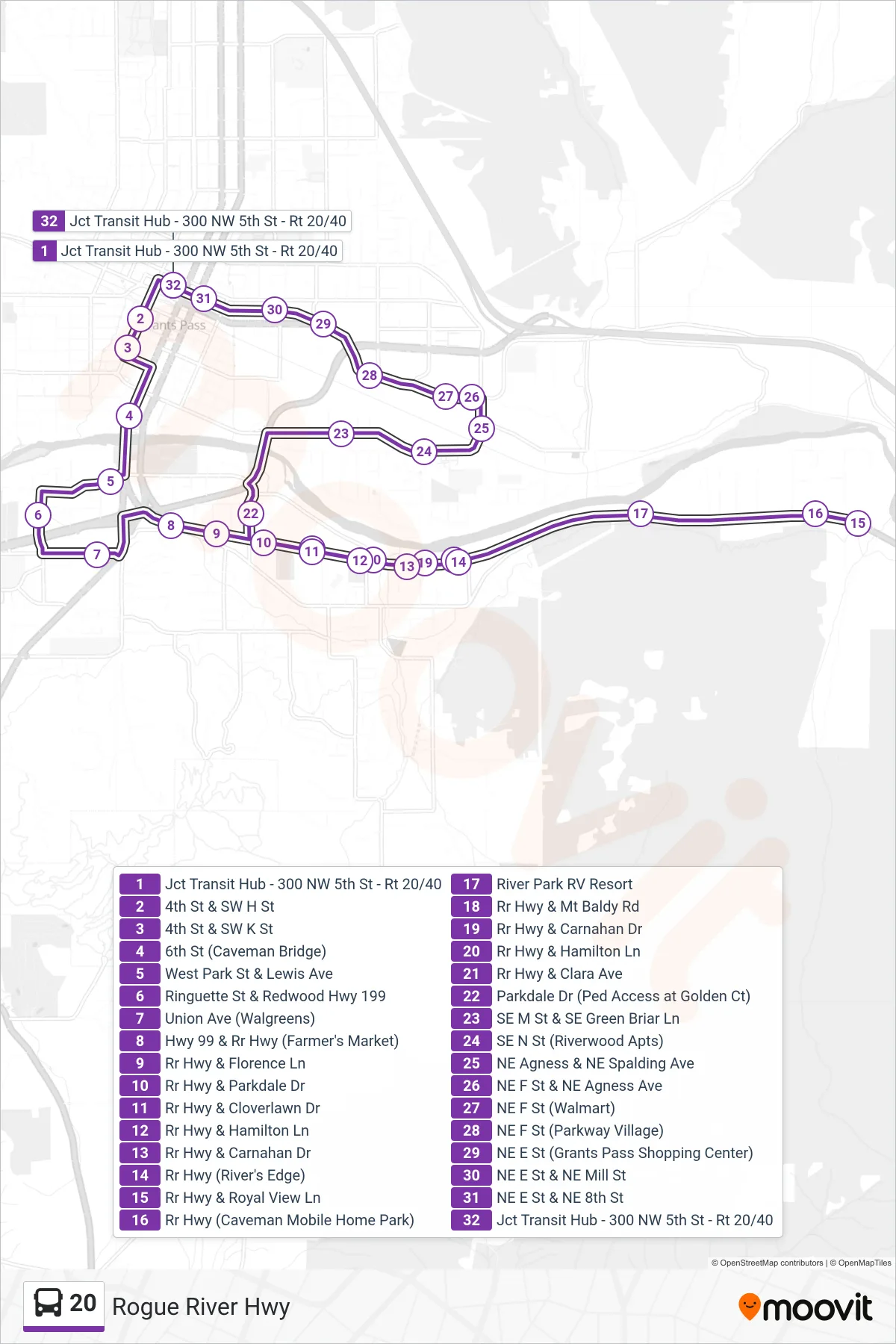
Stops list (20 - Rogue River Hwy)
- Jct Transit Hub - 300 NW 5th St - Rt 20/40
- 4th St & SW H St
- 4th St & SW K St
- 6th St (Caveman Bridge)
- West Park St & Lewis Ave
- Ringuette St & Redwood Hwy 199
- Union Ave (Walgreens)
- Hwy 99 & Rr Hwy (Farmer's Market)
- Rr Hwy & Florence Ln
- Rr Hwy & Parkdale Dr
- Rr Hwy & Cloverlawn Dr
- Rr Hwy & Hamilton Ln
- Rr Hwy & Carnahan Dr
- Rr Hwy (River's Edge)
- Rr Hwy & Royal View Ln
- Rr Hwy (Caveman Mobile Home Park)
- River Park RV Resort
- Rr Hwy & Mt Baldy Rd
- Rr Hwy & Carnahan Dr
- Rr Hwy & Hamilton Ln
- Rr Hwy & Clara Ave
- Parkdale Dr (Ped Access at Golden Ct)
- SE M St & SE Green Briar Ln
- SE N St (Riverwood Apts)
- NE Agness & NE Spalding Ave
- NE F St & NE Agness Ave
- NE F St (Walmart)
- NE F St (Parkway Village)
- NE E St (Grants Pass Shopping Center)
- NE E St & NE Mill St
- NE E St & NE 8th St
- Jct Transit Hub - 300 NW 5th St - Rt 20/40