
200 Bus Route Map
View the 200 route map and see all 200 stops along the route. The map of 200 shows where the bus travels and the location of each stop, making it easy to understand the entire route at a glance.
Explore ATM SpA Trapani routes on the map and see where ATM SpA Trapani bus services operate. Use the 200 map to find bus stops and see how the 200 connects different areas along its trip.
All 200 stops on the map are displayed in route order, helping you follow the 200 bus from the first stop to the last.
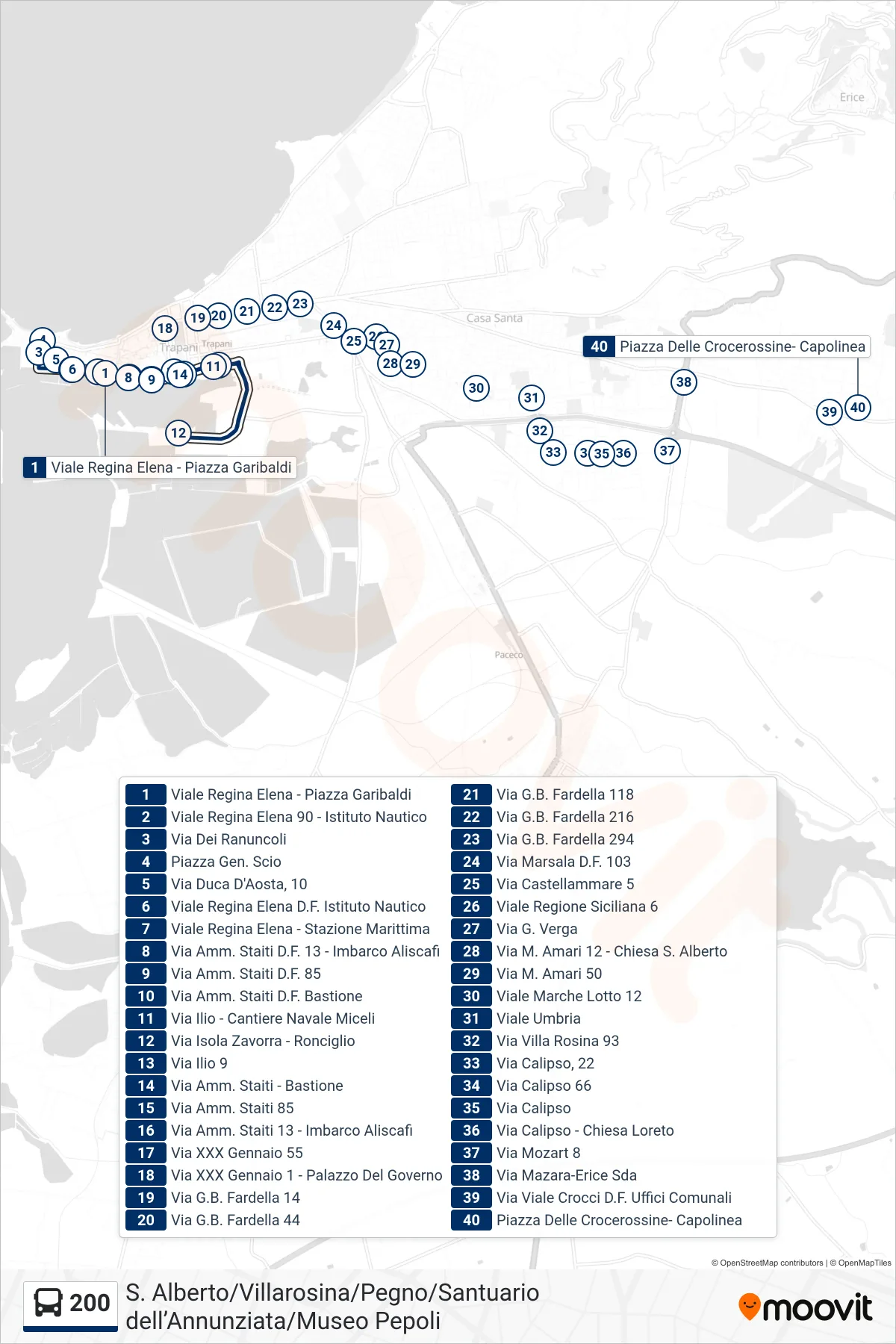
Stops list (200 - 200)
- Viale Regina Elena - Garibaldi Square
- 90 Queen Elena Avenue - Nautical Institute
- Dei Ranuncoli Street
- General Scio Square
- Duke of Aosta Street, 10
- Regina Elena Boulevard - Nautical Institute
- Queen Elena Avenue - Maritime Station
- Admiral Staiti Street 13 - Hydrofoil Boarding
- Via Amm. Staiti D.F. 85
- Admiral Staiti D.F. Bastion Street
- Ilio Street - Miceli Shipyard
- Zavorra Island Street - Ronciglio
- Via Ilio 9
- Admiral Staiti Street - Bastion
- Via Admiral Staiti 85
- Via Admiral Staiti 13 - Hydrofoil Boarding
- XXX January Street 55
- January 30th Street 1 - Government Palace
- G.B. Fardella Street 14
- G.B. Fardella Street 44
- G.B. Fardella Street 118
- Via G.B. Fardella 216
- G.B. Fardella Street 294
- Via Marsala D.F. 103
- Castellammare Street 5
- Viale Region Siciliana 6
- G. Verga Street
- M. Amari Road 12 - St. Albert Church
- Via M. Amari 50
- Viale Marche Lot 12
- Umbria Avenue
- Villa Rosina Street 93
- Calypso Street, 22
- Via Calipso 66
- Calypso Street
- Calipso Street - Loreto Church
- Mozart Street 8
- Via Mazara-Erice Road
- Via Crocci Avenue D.F. Municipal Offices
- Red Cross Square - Terminal