
21 Bus Route Map
View the 21 route map and see all 21 stops along the route. The map of 21 shows where the bus travels and the location of each stop, making it easy to understand the entire route at a glance.
Explore Cottbusverkehr routes on the map and see where Cottbusverkehr bus services operate. Use the 21 map to find bus stops and see how the 21 connects different areas along its trip.
All 21 stops on the map are displayed in route order, helping you follow the 21 bus from the first stop to the last.
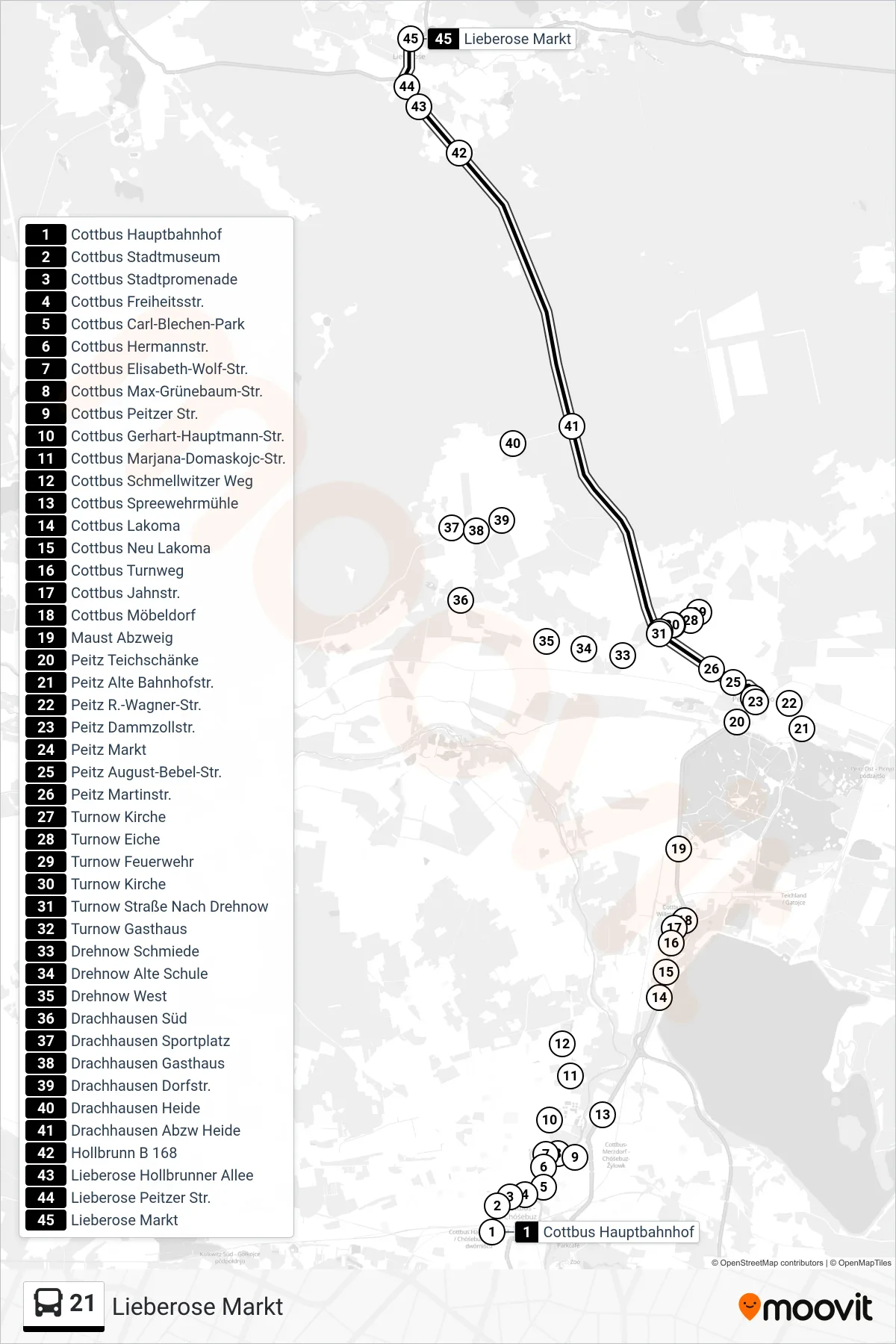
Stops list (21 - Lieberose Markt)
- Cottbus Hauptbahnhof
- Cottbus Stadtmuseum
- Cottbus Stadtpromenade
- Cottbus Freiheitsstr.
- Cottbus Carl-Blechen-Park
- Cottbus Hermannstr.
- Cottbus Elisabeth-Wolf-Str.
- Cottbus Max-Grünebaum-Str.
- Cottbus Peitzer Str.
- Cottbus Gerhart-Hauptmann-Str.
- Cottbus Marjana-Domaskojc-Str.
- Cottbus Schmellwitzer Weg
- Cottbus Spreewehrmühle
- Cottbus Lakoma
- Cottbus Neu Lakoma
- Cottbus Turnweg
- Cottbus Jahnstr.
- Cottbus Möbeldorf
- Maust Abzweig
- Peitz Teichschänke
- Peitz Alte Bahnhofstr.
- Peitz R.-Wagner-Str.
- Peitz Dammzollstr.
- Peitz Markt
- Peitz August-Bebel-Str.
- Peitz Martinstr.
- Turnow Kirche
- Turnow Eiche
- Turnow Feuerwehr
- Turnow Kirche
- Turnow Straße Nach Drehnow
- Turnow Gasthaus
- Drehnow Schmiede
- Drehnow Alte Schule
- Drehnow West
- Drachhausen Süd
- Drachhausen Sportplatz
- Drachhausen Gasthaus
- Drachhausen Dorfstr.
- Drachhausen Heide
- Drachhausen Abzw Heide
- Hollbrunn B 168
- Lieberose Hollbrunner Allee
- Lieberose Peitzer Str.
- Lieberose Markt