
21 Bus Route Map
View the 21 route map and see all 21 stops along the route. The map of 21 shows where the bus travels and the location of each stop, making it easy to understand the entire route at a glance.
Explore Franklin Regional Transit Authority routes on the map and see where Franklin Regional Transit Authority bus services operate. Use the 21 map to find bus stops and see how the 21 connects different areas along its trip.
All 21 stops on the map are displayed in route order, helping you follow the 21 bus from the first stop to the last.
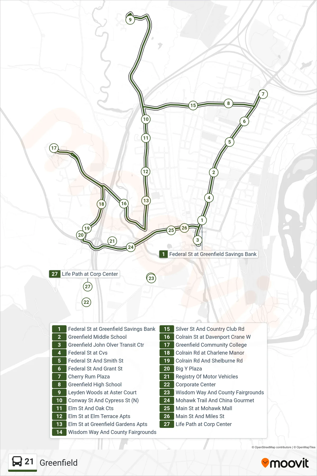
Stops list (21 - Jwo Transit Center)
- Federal St at Greenfield Savings Bank
- Greenfield Middle School
- Greenfield John Olver Transit Ctr
- Federal St at Cvs
- Federal St And Smith St
- Federal St And Grant St
- Cherry Rum Plaza
- Greenfield High School
- Leyden Woods at Aster Court
- Conway St And Cypress St (N)
- Elm St And Oak Cts
- Elm St at Elm Terrace Apts
- Elm St at Greenfield Gardens Apts
- Wisdom Way And County Fairgrounds
- Silver St And Country Club Rd
- Colrain St at Davenport Crane W
- Greenfield Community College
- Colrain Rd at Charlene Manor
- Colrain Rd And Shelburne Rd
- Big Y Plaza
- Registry Of Motor Vehicles
- Corporate Center
- Wisdom Way And County Fairgrounds
- Mohawk Trail And China Gourmet
- Main St at Mohawk Mall
- Main St And Miles St
- Life Path at Corp Center