
21 Bus Route Map
View the 21 route map and see all 21 stops along the route. The map of 21 shows where the bus travels and the location of each stop, making it easy to understand the entire route at a glance.
Explore RTC RIDE routes on the map and see where RTC RIDE bus services operate. Use the 21 map to find bus stops and see how the 21 connects different areas along its trip.
All 21 stops on the map are displayed in route order, helping you follow the 21 bus from the first stop to the last.
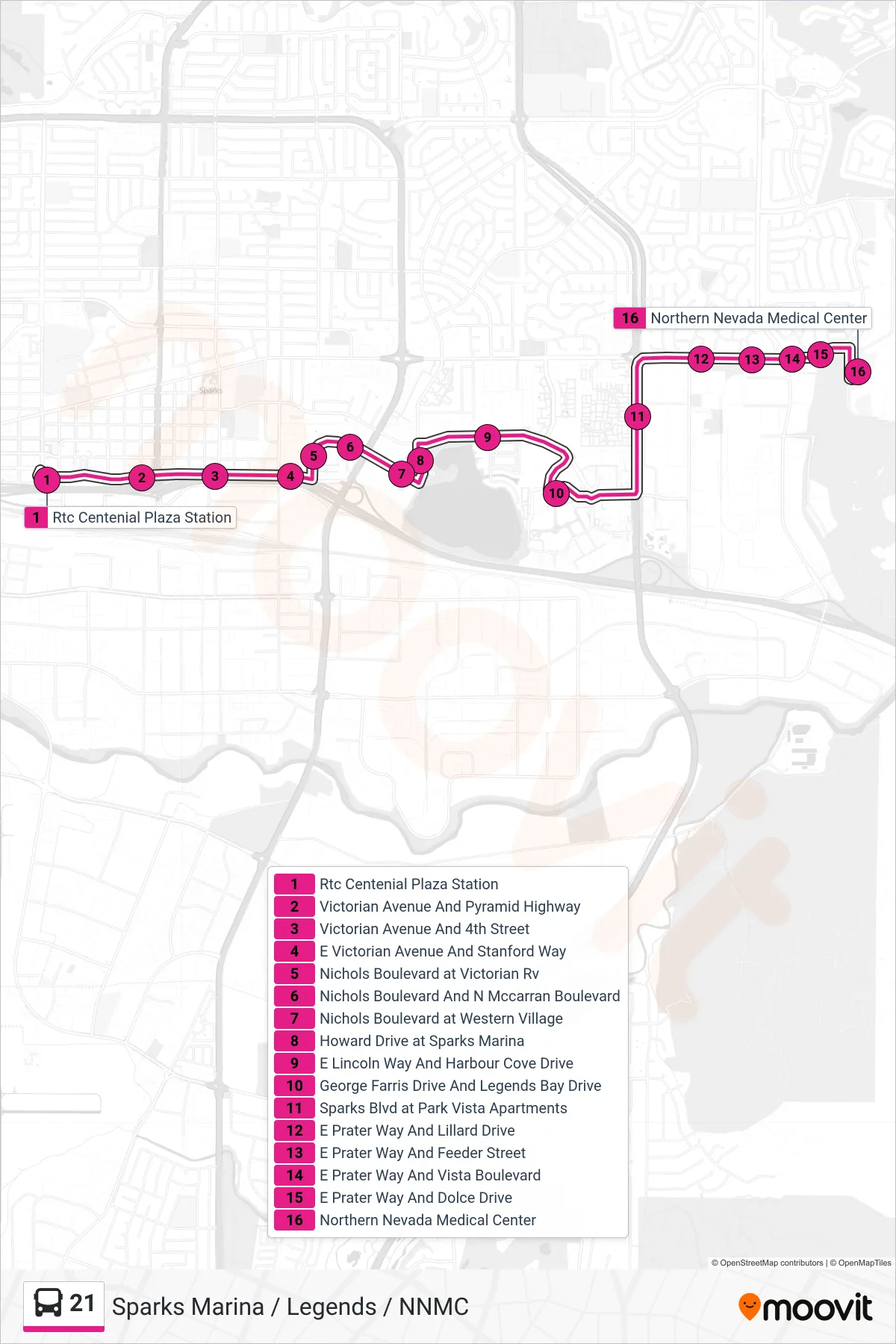
Stops list (21 - Lillard Drive And Prater Way)
- Rtc Centenial Plaza Station
- Victorian Avenue And Pyramid Highway
- Victorian Avenue And 4th Street
- E Victorian Avenue And Stanford Way
- Nichols Boulevard at Victorian Rv
- Nichols Boulevard And N Mccarran Boulevard
- Nichols Boulevard at Western Village
- Howard Drive at Sparks Marina
- E Lincoln Way And Harbour Cove Drive
- George Farris Drive And Legends Bay Drive
- Sparks Blvd at Park Vista Apartments
- E Prater Way And Lillard Drive
- E Prater Way And Feeder Street
- E Prater Way And Vista Boulevard
- E Prater Way And Dolce Drive
- Northern Nevada Medical Center