
21 Bus Route Map
View the 21 route map and see all 21 stops along the route. The map of 21 shows where the bus travels and the location of each stop, making it easy to understand the entire route at a glance.
Explore Aachener Straßenbahn- und Energieversorgungs-AG routes on the map and see where Aachener Straßenbahn- und Energieversorgungs-AG bus services operate. Use the 21 map to find bus stops and see how the 21 connects different areas along its trip.
All 21 stops on the map are displayed in route order, helping you follow the 21 bus from the first stop to the last.
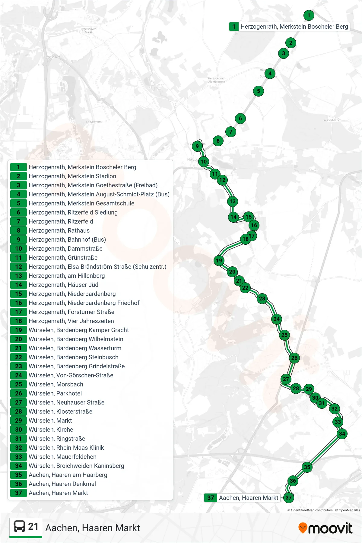
Stops list (21 - Aachen, Haaren Markt)
- Herzogenrath, Merkstein Boscheler Berg
- Herzogenrath, Merkstein Stadion
- Herzogenrath, Merkstein Goethestraße (Freibad)
- Herzogenrath, Merkstein August-Schmidt-Platz (Bus)
- Herzogenrath, Merkstein Gesamtschule
- Herzogenrath, Ritzerfeld Siedlung
- Herzogenrath, Ritzerfeld
- Herzogenrath, Rathaus
- Herzogenrath, Bahnhof (Bus)
- Herzogenrath, Dammstraße
- Herzogenrath, Grünstraße
- Herzogenrath, Elsa-Brändström-Straße (Schulzentr.)
- Herzogenrath, am Hillenberg
- Herzogenrath, Häuser Jüd
- Herzogenrath, Niederbardenberg
- Herzogenrath, Niederbardenberg Friedhof
- Herzogenrath, Forstumer Straße
- Herzogenrath, Vier Jahreszeiten
- Würselen, Bardenberg Kamper Gracht
- Würselen, Bardenberg Wilhelmstein
- Würselen, Bardenberg Wasserturm
- Würselen, Bardenberg Steinbusch
- Würselen, Bardenberg Grindelstraße
- Würselen, Von-Görschen-Straße
- Würselen, Morsbach
- Würselen, Parkhotel
- Würselen, Neuhauser Straße
- Würselen, Klosterstraße
- Würselen, Markt
- Würselen, Kirche
- Würselen, Ringstraße
- Würselen, Rhein-Maas Klinik
- Würselen, Mauerfeldchen
- Würselen, Broichweiden Kaninsberg
- Aachen, Haaren am Haarberg
- Aachen, Haaren Denkmal
- Aachen, Haaren Markt
Change direction
- Route Map - 21 - Würselen Parkhotel
- Route Map - 21 - Herzogenrath Bahnhof (Weiter Als Li. 47)
- Route Map - 21 - Aachen, Vinzenzplatz (Karl-Marx-Allee)
- Route Map - 21 - Herzogenrath Bahnhof (Weiter Als Li. 54)
- Route Map - 21 - Aachen Bushof
- Route Map - 21 - Boscheln Holthausen
- Route Map - 21 - Herzogenrath, Bahnhof (Bus)
- Route Map - 21 - Aachen, Fuchserde (Waldfriedhof Nord)
- Route Map - 21 - Bardenberg Kamper Gracht
- Route Map - 21 - Bardenberg Pley
- Route Map - 21 - Palenberg Bahnhof
- Route Map - 21 - Aachen, Lintert Friedhof
- Route Map - 21 - Bardenberg Wasserturm
- Route Map - 21 - Merkstein Boscheler Berg
- Route Map - 21 - Vinzenzplatz
- Route Map - 21 - Aachen Hauptbahnhof
- Route Map - 21 - Herzogenrath, Merkstein Boscheler Berg
- Route Map - 21 - Lintert Friedhof
- Route Map - 21 - Übach-Palenberg, Bahnhof (Bus)
- Route Map - 21 - Aachen Bushof (Weiter Als Li. 11)
- Route Map - 21 - Herzogenrath Bahnhof