
21 Bus Route Map
View the 21 route map and see all 21 stops along the route. The map of 21 shows where the bus travels and the location of each stop, making it easy to understand the entire route at a glance.
Explore Bayer routes on the map and see where Bayer bus services operate. Use the 21 map to find bus stops and see how the 21 connects different areas along its trip.
All 21 stops on the map are displayed in route order, helping you follow the 21 bus from the first stop to the last.
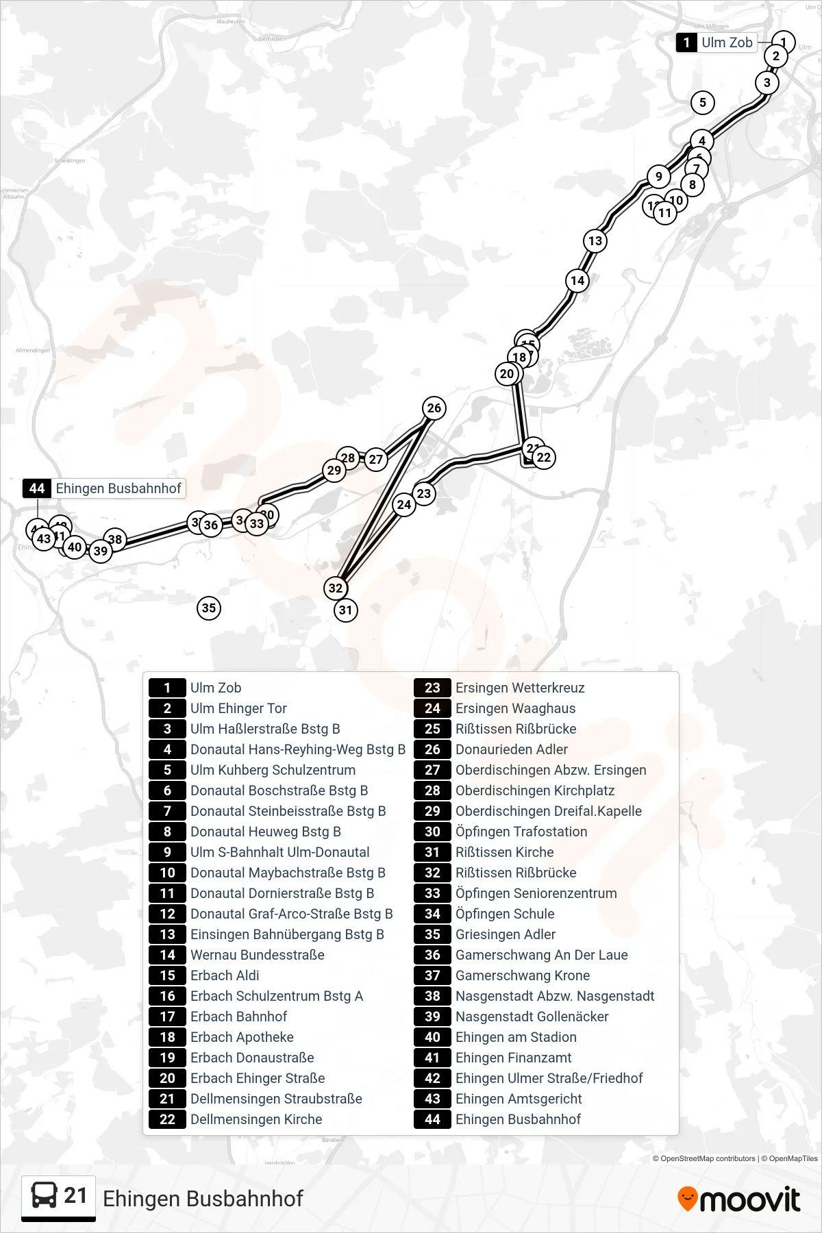
Stops list (21 - Ehingen Busbahnhof)
- Ulm Zob
- Ulm Ehinger Tor
- Ulm Haßlerstraße Bstg B
- Donautal Hans-Reyhing-Weg Bstg B
- Ulm Kuhberg Schulzentrum
- Donautal Boschstraße Bstg B
- Donautal Steinbeisstraße Bstg B
- Donautal Heuweg Bstg B
- Ulm S-Bahnhalt Ulm-Donautal
- Donautal Maybachstraße Bstg B
- Donautal Dornierstraße Bstg B
- Donautal Graf-Arco-Straße Bstg B
- Einsingen Bahnübergang Bstg B
- Wernau Bundesstraße
- Erbach Aldi
- Erbach Schulzentrum Bstg A
- Erbach Bahnhof
- Erbach Apotheke
- Erbach Donaustraße
- Erbach Ehinger Straße
- Dellmensingen Straubstraße
- Dellmensingen Kirche
- Ersingen Wetterkreuz
- Ersingen Waaghaus
- Rißtissen Rißbrücke
- Donaurieden Adler
- Oberdischingen Abzw. Ersingen
- Oberdischingen Kirchplatz
- Oberdischingen Dreifal.Kapelle
- Öpfingen Trafostation
- Rißtissen Kirche
- Rißtissen Rißbrücke
- Öpfingen Seniorenzentrum
- Öpfingen Schule
- Griesingen Adler
- Gamerschwang An Der Laue
- Gamerschwang Krone
- Nasgenstadt Abzw. Nasgenstadt
- Nasgenstadt Gollenäcker
- Ehingen am Stadion
- Ehingen Finanzamt
- Ehingen Ulmer Straße/Friedhof
- Ehingen Amtsgericht
- Ehingen Busbahnhof
Change direction
- Route Map - 21 - Oberdischingen Abzw. Ersingen
- Route Map - 21 - Erbach Bahnhof
- Route Map - 21 - Ulm Zob
- Route Map - 21 - Ulm Ehinger Tor
- Route Map - 21 - Rißtissen Rißbrücke
- Route Map - 21 - Ehingen Birkenweg
- Route Map - 21 - Erbach Schulzentrum
- Route Map - 21 - Griesingen Adler
- Route Map - 21 - Ulm Kuhberg Schulzentrum
- Route Map - 21 - Donautal Boschstraße