
210 Bus Route Map
View the 210 route map and see all 210 stops along the route. The map of 210 shows where the bus travels and the location of each stop, making it easy to understand the entire route at a glance.
Explore MBTA routes on the map and see where MBTA bus services operate. Use the 210 map to find bus stops and see how the 210 connects different areas along its trip.
All 210 stops on the map are displayed in route order, helping you follow the 210 bus from the first stop to the last.
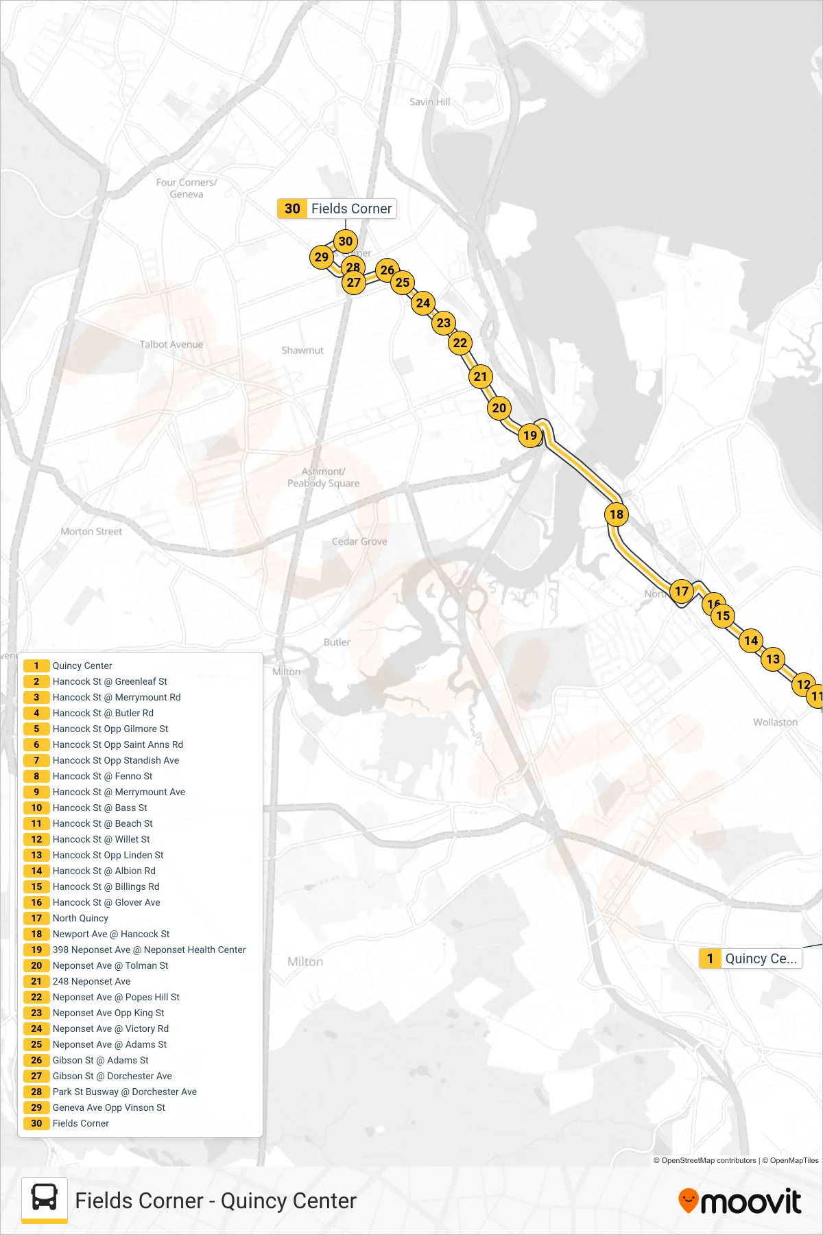
Stops list (210 - Fields Corner)
- Quincy Center
- Hancock St @ Greenleaf St
- Hancock St @ Merrymount Rd
- Hancock St @ Butler Rd
- Hancock St Opp Gilmore St
- Hancock St Opp Saint Anns Rd
- Hancock St Opp Standish Ave
- Hancock St @ Fenno St
- Hancock St @ Merrymount Ave
- Hancock St @ Bass St
- Hancock St @ Beach St
- Hancock St @ Willet St
- Hancock St Opp Linden St
- Hancock St @ Albion Rd
- Hancock St @ Billings Rd
- Hancock St @ Glover Ave
- North Quincy
- Newport Ave @ Hancock St
- 398 Neponset Ave @ Neponset Health Center
- Neponset Ave @ Tolman St
- 248 Neponset Ave
- Neponset Ave @ Popes Hill St
- Neponset Ave Opp King St
- Neponset Ave @ Victory Rd
- Neponset Ave @ Adams St
- Gibson St @ Adams St
- Gibson St @ Dorchester Ave
- Park St Busway @ Dorchester Ave
- Geneva Ave Opp Vinson St
- Fields Corner