
210 Bus Route Map
View the 210 route map and see all 210 stops along the route. The map of 210 shows where the bus travels and the location of each stop, making it easy to understand the entire route at a glance.
Explore Vestische routes on the map and see where Vestische bus services operate. Use the 210 map to find bus stops and see how the 210 connects different areas along its trip.
All 210 stops on the map are displayed in route order, helping you follow the 210 bus from the first stop to the last.
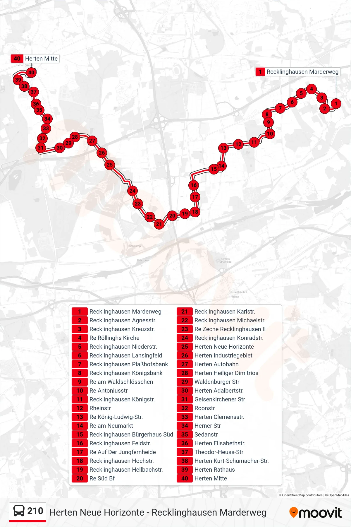
Stops list (210 - Herten Mitte)
- Recklinghausen Marderweg
- Recklinghausen Agnesstr.
- Recklinghausen Kreuzstr.
- Re Röllinghs Kirche
- Recklinghausen Niederstr.
- Recklinghausen Lansingfeld
- Recklinghausen Plaßhofsbank
- Recklinghausen Königsbank
- Re am Waldschlösschen
- Re Antoniusstr
- Recklinghausen Königstr.
- Rheinstr
- Re König-Ludwig-Str.
- Re am Neumarkt
- Recklinghausen Bürgerhaus Süd
- Recklinghausen Feldstr.
- Re Auf Der Jungfernheide
- Recklinghausen Hochstr.
- Recklinghausen Hellbachstr.
- Re Süd Bf
- Recklinghausen Karlstr.
- Recklinghausen Michaelstr.
- Re Zeche Recklinghausen II
- Recklinghausen Konradstr.
- Herten Neue Horizonte
- Herten Industriegebiet
- Herten Autobahn
- Herten Heiliger Dimitrios
- Waldenburger Str
- Herten Adalbertstr.
- Gelsenkirchener Str
- Roonstr
- Herten Clemensstr.
- Herner Str
- Sedanstr
- Herten Elisabethstr.
- Theodor-Heuss-Str
- Herten Kurt-Schumacher-Str.
- Herten Rathaus
- Herten Mitte