
212 Bus Route Map
View the 212 route map and see all 212 stops along the route. The map of 212 shows where the bus travels and the location of each stop, making it easy to understand the entire route at a glance.
Explore Sydtrafik routes on the map and see where Sydtrafik bus services operate. Use the 212 map to find bus stops and see how the 212 connects different areas along its trip.
All 212 stops on the map are displayed in route order, helping you follow the 212 bus from the first stop to the last.
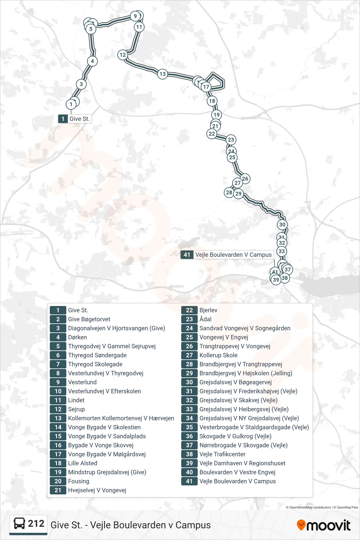
Stops list (212 - Vejle)
- Give St.
- Give Bøgetorvet
- Diagonalvejen V Hjortsvangen (Give)
- Dørken
- Thyregodvej V Gammel Sejrupvej
- Thyregod Søndergade
- Thyregod Skolegade
- Vesterlundvej V Thyregodvej
- Vesterlund
- Vesterlundvej V Efterskolen
- Lindet
- Sejrup
- Kollemorten Kollemortenvej V Hærvejen
- Vonge Bygade V Skolestien
- Vonge Bygade V Sandalplads
- Bygade V Vonge Skovvej
- Lille Alsted
- Mindstrup Grejsdalsvej (Give)
- Fousing
- Hvejselvej V Vongevej
- Bjerlev
- Ådal
- Sandvad Vongevej V Sognegården
- Vongevej V Engvej
- Trangtrappevej V Vongevej
- Kollerup Skole
- Brandbjergvej V Trangtrappevej
- Brandbjergvej V Højskolen (Jelling)
- Grejsdalsvej V Bøgeagervej
- Grejsdalsvej V Frederikshøjvej (Vejle)
- Grejsdalsvej V Skakvej (Vejle)
- Grejsdalsvej V Heibergsvej (Vejle)
- Grejsdalsvej V NY Grejsdalsvej (Vejle)
- Vesterbrogade V Staldgaardsgade (Vejle)
- Skovgade V Gulkrog (Vejle)
- Nørrebrogade V Skovgade (Vejle)
- Vejle Trafikcenter
- Vejle Damhaven V Regionshuset
- Boulevarden V Vestre Engvej
- Vejle Boulevarden V Campus