
212 Bus Route Map
View the 212 route map and see all 212 stops along the route. The map of 212 shows where the bus travels and the location of each stop, making it easy to understand the entire route at a glance.
Explore Nomad Car (Région Normandie) routes on the map and see where Nomad Car (Région Normandie) bus services operate. Use the 212 map to find bus stops and see how the 212 connects different areas along its trip.
All 212 stops on the map are displayed in route order, helping you follow the 212 bus from the first stop to the last.
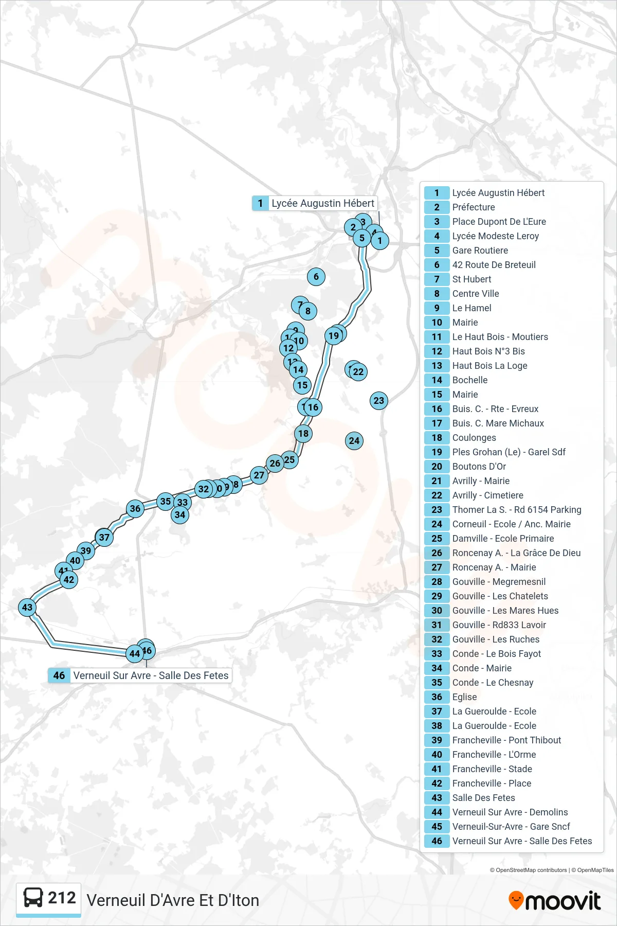
Stops list (212 - Verneuil D'Avre Et D'Iton)
- Lycée Augustin Hébert
- Préfecture
- Place Dupont De L'Eure
- Lycée Modeste Leroy
- Gare Routiere
- 42 Route De Breteuil
- St Hubert
- Centre Ville
- Le Hamel
- Mairie
- Le Haut Bois - Moutiers
- Haut Bois N°3 Bis
- Haut Bois La Loge
- Bochelle
- Mairie
- Buis. C. - Rte - Evreux
- Buis. C. Mare Michaux
- Coulonges
- Ples Grohan (Le) - Garel Sdf
- Boutons D'Or
- Avrilly - Mairie
- Avrilly - Cimetiere
- Thomer La S. - Rd 6154 Parking
- Corneuil - Ecole / Anc. Mairie
- Damville - Ecole Primaire
- Roncenay A. - La Grâce De Dieu
- Roncenay A. - Mairie
- Gouville - Megremesnil
- Gouville - Les Chatelets
- Gouville - Les Mares Hues
- Gouville - Rd833 Lavoir
- Gouville - Les Ruches
- Conde - Le Bois Fayot
- Conde - Mairie
- Conde - Le Chesnay
- Eglise
- La Gueroulde - Ecole
- La Gueroulde - Ecole
- Francheville - Pont Thibout
- Francheville - L'Orme
- Francheville - Stade
- Francheville - Place
- Salle Des Fetes
- Verneuil Sur Avre - Demolins
- Verneuil-Sur-Avre - Gare Sncf
- Verneuil Sur Avre - Salle Des Fetes