
216 Bus Route Map
View the 216 route map and see all 216 stops along the route. The map of 216 shows where the bus travels and the location of each stop, making it easy to understand the entire route at a glance.
Explore Bus Éireann routes on the map and see where Bus Éireann bus services operate. Use the 216 map to find bus stops and see how the 216 connects different areas along its trip.
All 216 stops on the map are displayed in route order, helping you follow the 216 bus from the first stop to the last.
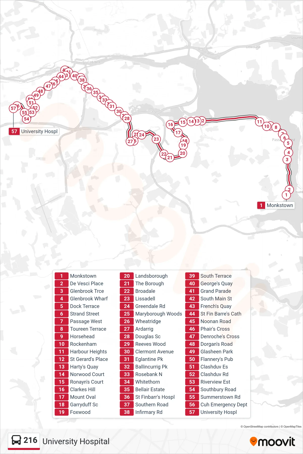
Stops list (216 - University Hospital)
- Monkstown
- De Vesci Place
- Glenbrook Trce
- Glenbrook Wharf
- Dock Terrace
- Strand Street
- Passage West
- Toureen Terrace
- Horsehead
- Rockenham
- Harbour Heights
- St Gerard's Place
- Harty's Quay
- Norwood Court
- Ronayn's Court
- Clarkes Hill
- Mount Oval
- Garryduff Sc
- Foxwood
- Landsborough
- The Borough
- Broadale
- Lissadell
- Greendale Rd
- Maryborough Woods
- Wheatridge
- Ardarrig
- Douglas Sc
- Reeves Wood
- Clermont Avenue
- Eglantine Pk
- Ballincurrig Pk
- Rosebank N
- Whitethorn
- Bellair Estate
- St Finbarr's Hospl
- Southern Road
- Infirmary Rd
- South Terrace
- George's Quay
- Grand Parade
- South Main St
- French's Quay
- St Fin Barre's Cath
- Noonan Road
- Phair's Cross
- Denroche's Cross
- Dorgan's Road
- Glasheen Park
- Flannery's Pub
- Clashduv Es
- Clashduv Rd
- Riverview Est
- Southbury Road
- Summerstown Rd
- Cuh Emergency Dept
- University Hospl