
22 Bus Route Map
View the 22 route map and see all 22 stops along the route. The map of 22 shows where the bus travels and the location of each stop, making it easy to understand the entire route at a glance.
Explore De Lijn routes on the map and see where De Lijn bus services operate. Use the 22 map to find bus stops and see how the 22 connects different areas along its trip.
All 22 stops on the map are displayed in route order, helping you follow the 22 bus from the first stop to the last.
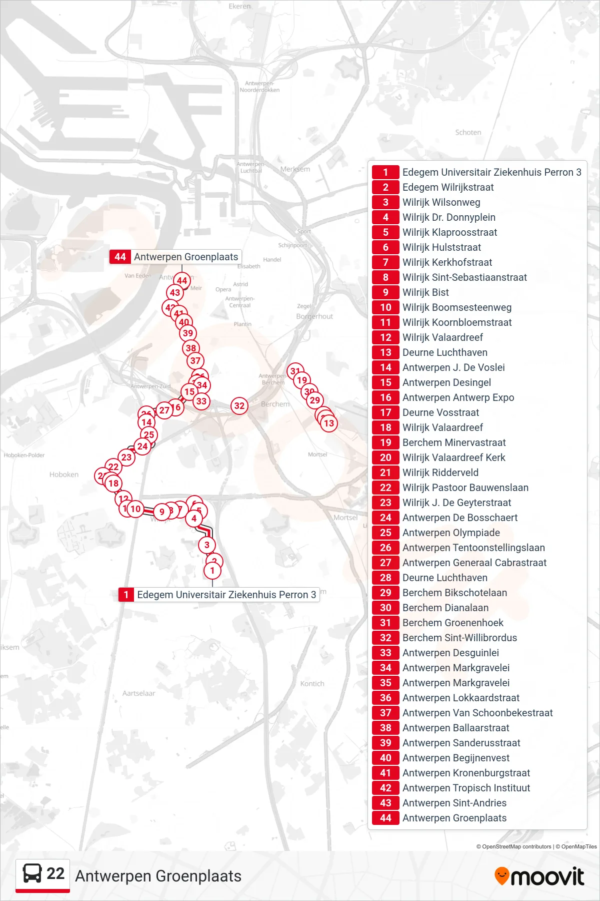
Stops list (22 - Antwerp Green Square)
- Edegem University Hospital Platform 3
- Edegem Wilrijkstraat
- Wilrijk Wilson Way
- Wilrijk Dr. Donny Square
- Wilrijk Poppy Street
- Wilrijk Hulst Street
- Wilrijk Cemetery Street
- Wilrijk Saint Sebastian Street
- Wilrijk Bist
- Wilrijk Boomse Road
- Wilrijk Cornflower Street
- Wilrijk Valaar Drive
- Deurne Airport
- Antwerp J. De Voslei
- Antwerp Desingel
- Antwerp Expo
- Deurne Fox Street
- Wilrijk Valaar Drive
- Berchem Minerva Street
- Wilrijk Valaard Drive Church
- Wilrijk Ridderveld
- Wilrijk Pastor Bauwens Avenue
- Wilrijk J. De Geyter Street
- Antwerp De Bosschaert
- Antwerp Olympics
- Antwerp Exhibition Avenue
- Antwerp General Cabra Street
- Deurne Airport
- Berchem Bikschotel Avenue
- Berchem Diana Avenue
- Berchem Groenenhoek
- Berchem Saint Willibrordus
- Antwerp Desguinlei
- Antwerp Markgrave Avenue
- Antwerp Markgrave Avenue
- Antwerp Lokkaard Street
- Antwerp Van Schoonbeke Street
- Antwerp Ballaarstraat
- Antwerp Sanderus Street
- Antwerp Beguinage Rampart
- Antwerp Kronenburg Street
- Antwerp Tropical Institute
- Antwerp Saint Andrews
- Antwerp Green Square