
22 Bus Route Map
View the 22 route map and see all 22 stops along the route. The map of 22 shows where the bus travels and the location of each stop, making it easy to understand the entire route at a glance.
Explore KP Kyivpastrans routes on the map and see where KP Kyivpastrans bus services operate. Use the 22 map to find bus stops and see how the 22 connects different areas along its trip.
All 22 stops on the map are displayed in route order, helping you follow the 22 bus from the first stop to the last.
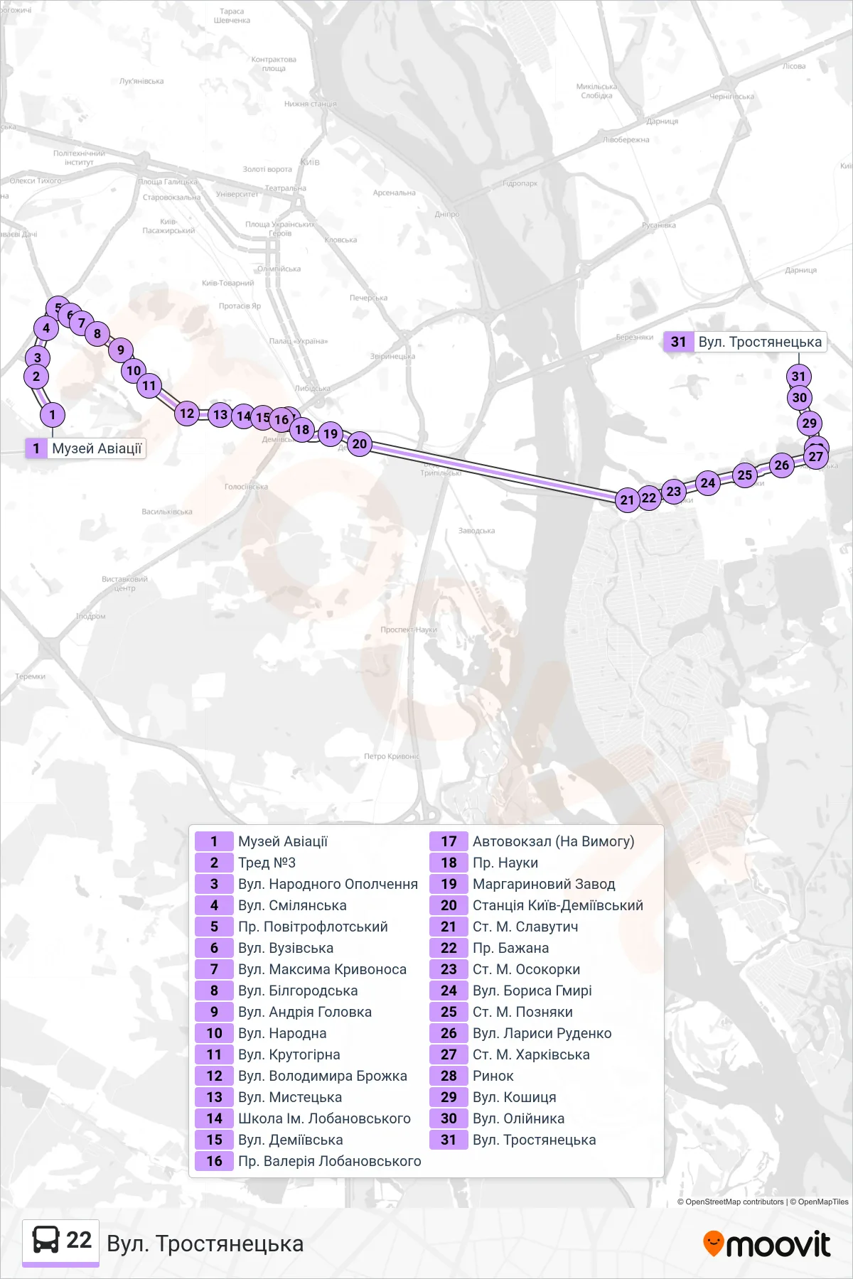
Stops list (22 - Trostianetska Street)
- Aviation Museum
- Trade #3
- Narodnoho Opolchennia Street
- Smilianska St
- Povitroflotsky Ave
- Vuzivska St
- Maksyma Kryvonosa Street
- Bilhorodska St
- Andriia Holovka St
- Narodna Street
- Krutohirna Street
- Volodymyr Brozhko Street
- Mystetska Street
- Lobanovskyi School
- Demiivska Street
- Valerii Lobanovskyi Ave
- Bus Station (On Demand)
- Science Avenue
- Margarine Factory
- Kyiv-Demiivskyi Station
- Slavutych Metro Station
- Bazhana Ave
- Osokorky Metro Station
- Borys Hmyri St
- Pozniaky Metro Station
- Larysa Rudenko Street
- Kharkivska Metro Station
- Market
- Koshytsia Street
- Oliinyka Street
- Trostianetska Street