
22 Bus Route Map
View the 22 route map and see all 22 stops along the route. The map of 22 shows where the bus travels and the location of each stop, making it easy to understand the entire route at a glance.
Explore Omnibus Friedrich routes on the map and see where Omnibus Friedrich bus services operate. Use the 22 map to find bus stops and see how the 22 connects different areas along its trip.
All 22 stops on the map are displayed in route order, helping you follow the 22 bus from the first stop to the last.
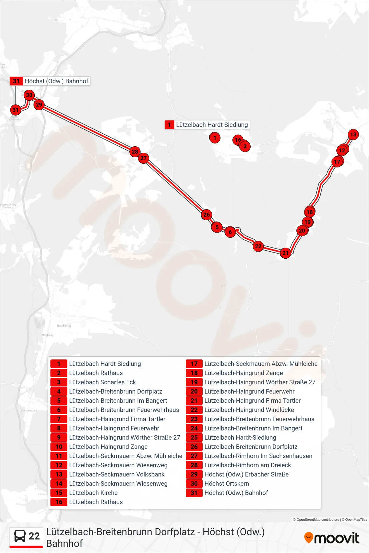
Stops list (22 - Höchst Bhf)
- Lützelbach Hardt-Siedlung
- Lützelbach Rathaus
- Lützelbach Scharfes Eck
- Lützelbach-Breitenbrunn Dorfplatz
- Lützelbach-Breitenbrunn Im Bangert
- Lützelbach-Breitenbrunn Feuerwehrhaus
- Lützelbach-Haingrund Firma Tartler
- Lützelbach-Haingrund Feuerwehr
- Lützelbach-Haingrund Wörther Straße 27
- Lützelbach-Haingrund Zange
- Lützelbach-Seckmauern Abzw. Mühleiche
- Lützelbach-Seckmauern Wiesenweg
- Lützelbach-Seckmauern Volksbank
- Lützelbach-Seckmauern Wiesenweg
- Lützelbach Kirche
- Lützelbach Rathaus
- Lützelbach-Seckmauern Abzw. Mühleiche
- Lützelbach-Haingrund Zange
- Lützelbach-Haingrund Wörther Straße 27
- Lützelbach-Haingrund Feuerwehr
- Lützelbach-Haingrund Firma Tartler
- Lützelbach-Haingrund Windlücke
- Lützelbach-Breitenbrunn Feuerwehrhaus
- Lützelbach-Breitenbrunn Im Bangert
- Lützelbach Hardt-Siedlung
- Lützelbach-Breitenbrunn Dorfplatz
- Lützelbach-Rimhorn Im Sachsenhausen
- Lützelbach-Rimhorn am Dreieck
- Höchst (Odw.) Erbacher Straße
- Höchst Ortskern
- Höchst (Odw.) Bahnhof
Change direction
- Route Map - 22 - Rai-Breitenbach
- Route Map - 22 - Bad König Cws
- Route Map - 22 - Lützelbach
- Route Map - 22 - Breitenbrunn
- Route Map - 22 - Lützelbach Schule
- Route Map - 22 - Haingrund
- Route Map - 22 - Lützelbach
- Route Map - 22 - Rimhorn
- Route Map - 22 - Rai-Breitenbach
- Route Map - 22 - Seckmauern
- Route Map - 22 - Höchst Egs
- Route Map - 22 - Seckmauern