
22 Bus Route Map
View the 22 route map and see all 22 stops along the route. The map of 22 shows where the bus travels and the location of each stop, making it easy to understand the entire route at a glance.
Explore VerkehrsService GmbH Groß-Gerau routes on the map and see where VerkehrsService GmbH Groß-Gerau bus services operate. Use the 22 map to find bus stops and see how the 22 connects different areas along its trip.
All 22 stops on the map are displayed in route order, helping you follow the 22 bus from the first stop to the last.
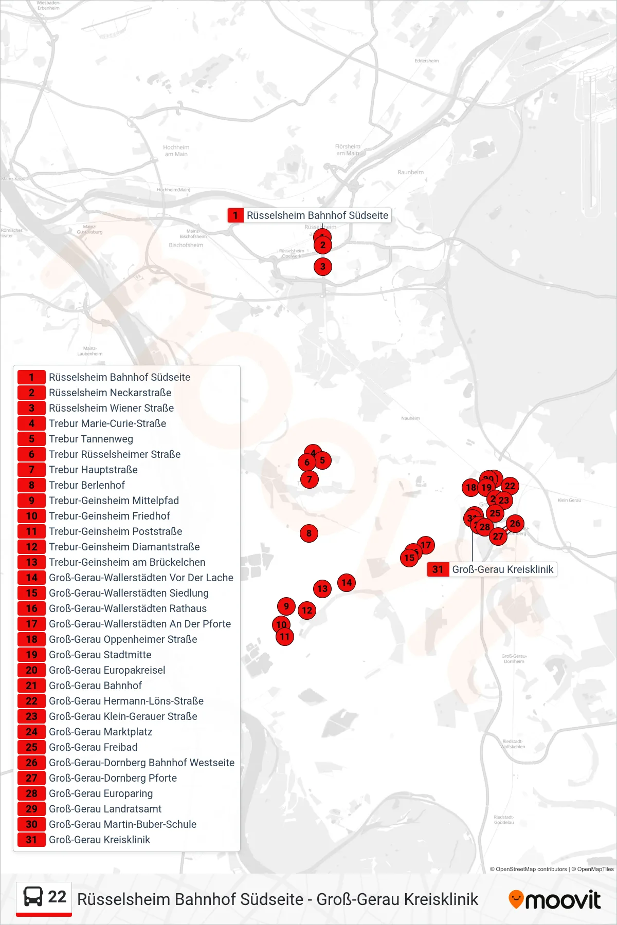
Stops list (22 - Groß-Gerau Kreisklinik)
- Rüsselsheim Bahnhof Südseite
- Rüsselsheim Neckarstraße
- Rüsselsheim Wiener Straße
- Trebur Marie-Curie-Straße
- Trebur Tannenweg
- Trebur Rüsselsheimer Straße
- Trebur Hauptstraße
- Trebur Berlenhof
- Trebur-Geinsheim Mittelpfad
- Trebur-Geinsheim Friedhof
- Trebur-Geinsheim Poststraße
- Trebur-Geinsheim Diamantstraße
- Trebur-Geinsheim am Brückelchen
- Groß-Gerau-Wallerstädten Vor Der Lache
- Groß-Gerau-Wallerstädten Siedlung
- Groß-Gerau-Wallerstädten Rathaus
- Groß-Gerau-Wallerstädten An Der Pforte
- Groß-Gerau Oppenheimer Straße
- Groß-Gerau Stadtmitte
- Groß-Gerau Europakreisel
- Groß-Gerau Bahnhof
- Groß-Gerau Hermann-Löns-Straße
- Groß-Gerau Klein-Gerauer Straße
- Groß-Gerau Marktplatz
- Groß-Gerau Freibad
- Groß-Gerau-Dornberg Bahnhof Westseite
- Groß-Gerau-Dornberg Pforte
- Groß-Gerau Europaring
- Groß-Gerau Landratsamt
- Groß-Gerau Martin-Buber-Schule
- Groß-Gerau Kreisklinik