
22 Bus Route Map
View the 22 route map and see all 22 stops along the route. The map of 22 shows where the bus travels and the location of each stop, making it easy to understand the entire route at a glance.
Explore ATM Messina routes on the map and see where ATM Messina bus services operate. Use the 22 map to find bus stops and see how the 22 connects different areas along its trip.
All 22 stops on the map are displayed in route order, helping you follow the 22 bus from the first stop to the last.
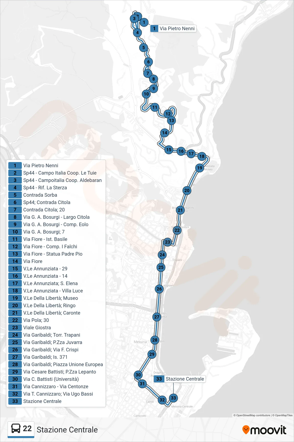
Stops list (22 - Central Station)
- Pietro Nenni Street
- SP44 - Campo Italia Cooperative Le Tuie
- Sp44 - Campoitalia Aldebaran Cooperative
- Sp44 - La Sterza Refuge
- Sorba District
- Provincial Road 44; Citola District
- Contrada Citola 20
- Via G. A. Bosurgi - Largo Citola
- Via G. A. Bosurgi - Eolo Complex
- Via G. A. Bosurgi, 7
- Via Fiore - Basile Institute
- Via Fiore - Falchi Complex
- Via Fiore - Father Pio Statue
- Flower Street
- Annunziata Avenue - 29
- Annunziata Avenue - 14
- V.Le Annunziata - St. Elena
- Annunziata Avenue - Villa Luce
- Liberty Avenue; Museum
- Liberty Avenue; Ringo
- Liberty Avenue, Caronte
- Pola Street 30
- Giostra Avenue
- Garibaldi Street; Trapani Stream
- Garibaldi Street, Juvarra Square
- Via Garibaldi - Via F. Crispi
- Garibaldi Street Block 371
- Via Garibaldi - European Union Square
- Via Cesare Battisti - Lepanto Square
- C. Battisti Street (University)
- Via Cannizzaro - Via Centonze
- T. Cannizzaro Street; Ugo Bassi Street
- Central Station