
22 Bus Route Map
View the 22 route map and see all 22 stops along the route. The map of 22 shows where the bus travels and the location of each stop, making it easy to understand the entire route at a glance.
Explore Marin Transit routes on the map and see where Marin Transit bus services operate. Use the 22 map to find bus stops and see how the 22 connects different areas along its trip.
All 22 stops on the map are displayed in route order, helping you follow the 22 bus from the first stop to the last.
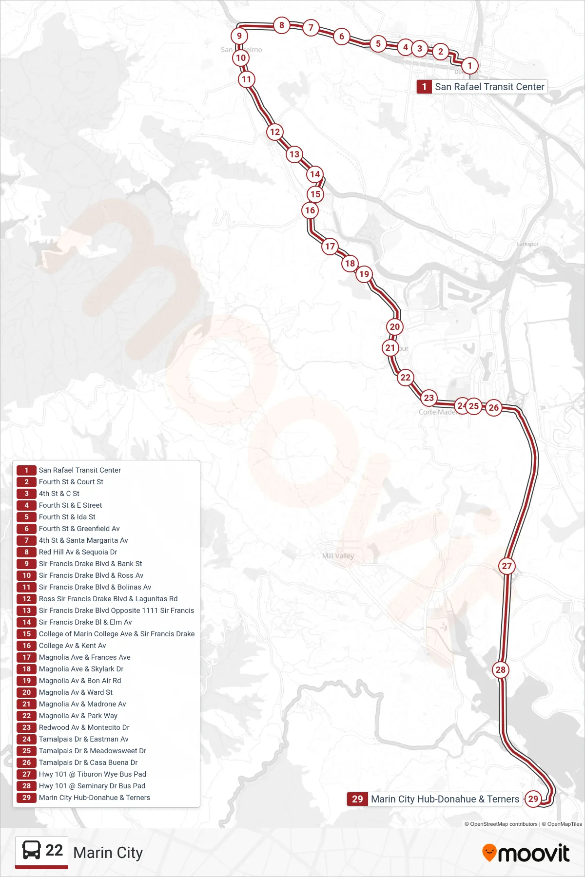
Stops list (22 - Marin City)
- San Rafael Transit Center
- Fourth St & Court St
- 4th St & C St
- Fourth St & E Street
- Fourth St & Ida St
- Fourth St & Greenfield Av
- 4th St & Santa Margarita Av
- Red Hill Av & Sequoia Dr
- Sir Francis Drake Blvd & Bank St
- Sir Francis Drake Blvd & Ross Av
- Sir Francis Drake Blvd & Bolinas Av
- Ross Sir Francis Drake Blvd & Lagunitas Rd
- Sir Francis Drake Blvd Opposite 1111 Sir Francis
- Sir Francis Drake Bl & Elm Av
- College of Marin College Ave & Sir Francis Drake
- College Av & Kent Av
- Magnolia Ave & Frances Ave
- Magnolia Ave & Skylark Dr
- Magnolia Av & Bon Air Rd
- Magnolia Av & Ward St
- Magnolia Av & Madrone Av
- Magnolia Av & Park Way
- Redwood Av & Montecito Dr
- Tamalpais Dr & Eastman Av
- Tamalpais Dr & Meadowsweet Dr
- Tamalpais Dr & Casa Buena Dr
- Hwy 101 @ Tiburon Wye Bus Pad
- Hwy 101 @ Seminary Dr Bus Pad
- Marin City Hub-Donahue & Terners