
22 Bus Route Map
View the 22 route map and see all 22 stops along the route. The map of 22 shows where the bus travels and the location of each stop, making it easy to understand the entire route at a glance.
Explore ATVO routes on the map and see where ATVO bus services operate. Use the 22 map to find bus stops and see how the 22 connects different areas along its trip.
All 22 stops on the map are displayed in route order, helping you follow the 22 bus from the first stop to the last.
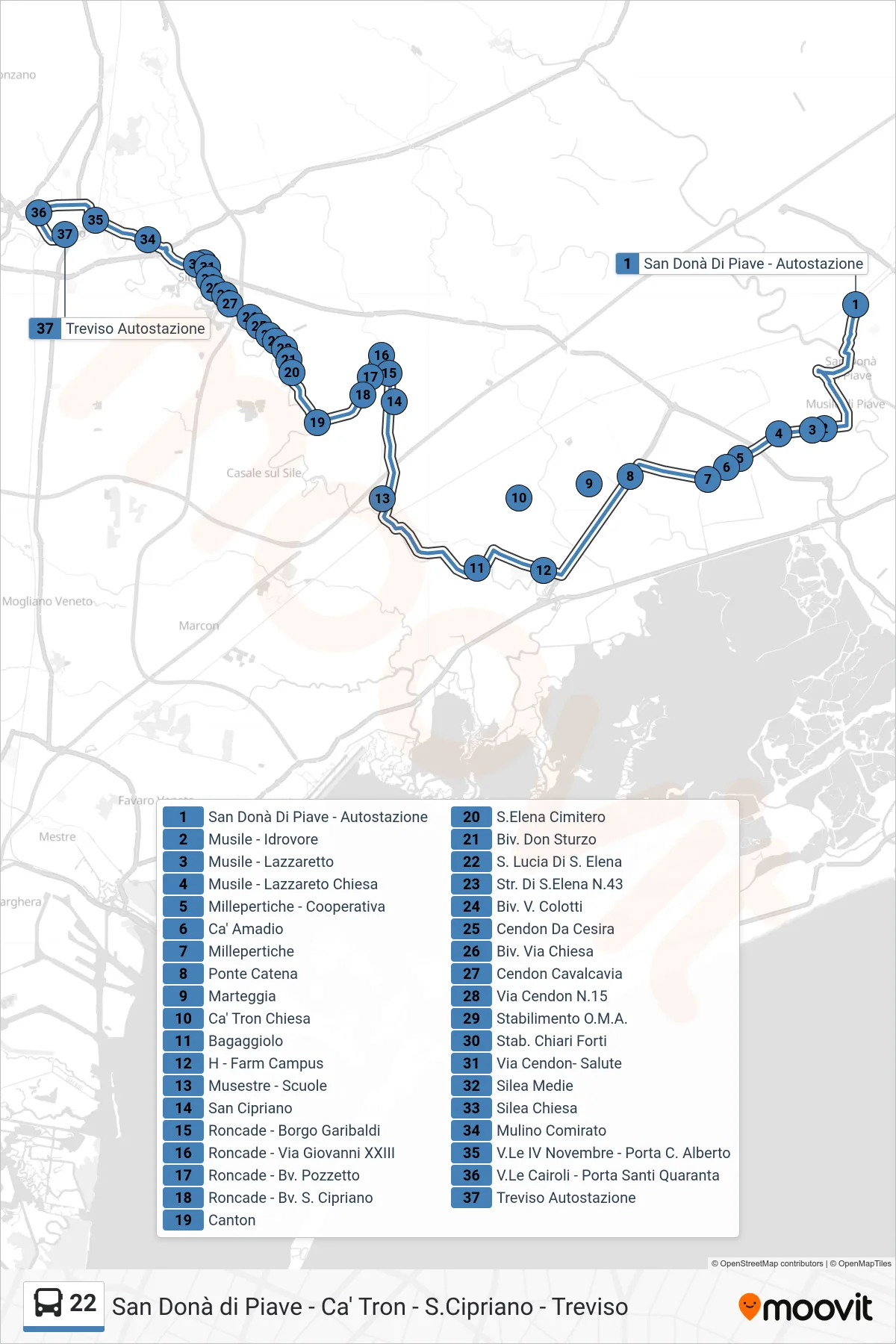
Stops list (22 - Treviso)
- San Donà Di Piave - Bus Station
- Musile - Pumping Station
- Musile - Lazzaretto
- Musile - Lazzaretto Church
- Millepertiche - Cooperative
- Ca' Amadio
- Millepertiche
- Chain Bridge
- Marteggia
- Ca' Tron Chiesa
- Bagaggiolo
- H - Farm Campus
- Musestre - Schools
- San Cipriano
- Roncade - Borgo Garibaldi
- Roncade - Giovanni XXIII Street
- Roncade - Pozzetto Crossroads
- Roncade - Saint Cipriano Boulevard
- Canton
- St. Elena Cemetery
- Don Sturzo Junction
- Santa Lucia Di Sant'Elena
- St. Elena Road No.43
- Colotti Street Junction
- Cendon Da Cesira
- Junction Via Chiesa
- Cendon Overpass
- Cendon Street No.15
- O.M.A. Facility
- Chiari Forti Factory
- Via Cendon- Salute
- Silea Middle School
- Silea Church
- Comirato Mill
- November 4th Avenue - Porta C. Alberto
- Cairoli Ave - Porta Santi Quaranta
- Treviso Bus Station