
220 Bus Route Map
View the 220 route map and see all 220 stops along the route. The map of 220 shows where the bus travels and the location of each stop, making it easy to understand the entire route at a glance.
Explore MBTA routes on the map and see where MBTA bus services operate. Use the 220 map to find bus stops and see how the 220 connects different areas along its trip.
All 220 stops on the map are displayed in route order, helping you follow the 220 bus from the first stop to the last.
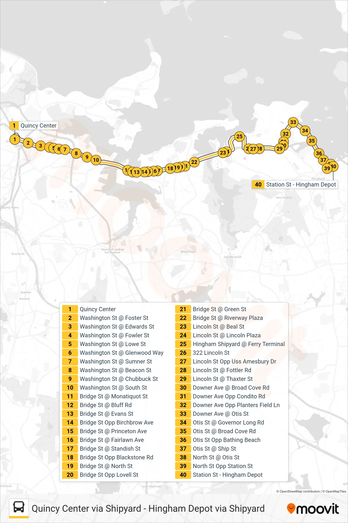
Stops list (220 - Hingham Depot Via Shipyard)
- Quincy Center
- Washington St @ Foster St
- Washington St @ Edwards St
- Washington St @ Fowler St
- Washington St @ Lowe St
- Washington St @ Glenwood Way
- Washington St @ Sumner St
- Washington St @ Beacon St
- Washington St @ Chubbuck St
- Washington St @ South St
- Bridge St @ Monatiquot St
- Bridge St @ Bluff Rd
- Bridge St @ Evans St
- Bridge St Opp Birchbrow Ave
- Bridge St @ Princeton Ave
- Bridge St @ Fairlawn Ave
- Bridge St @ Standish St
- Bridge St Opp Blackstone Rd
- Bridge St @ North St
- Bridge St Opp Lovell St
- Bridge St @ Green St
- Bridge St @ Riverway Plaza
- Lincoln St @ Beal St
- Lincoln St @ Lincoln Plaza
- Hingham Shipyard @ Ferry Terminal
- 322 Lincoln St
- Lincoln St Opp Uss Amesbury Dr
- Lincoln St @ Fottler Rd
- Lincoln St @ Thaxter St
- Downer Ave @ Broad Cove Rd
- Downer Ave Opp Condito Rd
- Downer Ave Opp Planters Field Ln
- Downer Ave @ Otis St
- Otis St @ Governor Long Rd
- Otis St @ Broad Cove Rd
- Otis St Opp Bathing Beach
- Otis St @ Ship St
- North St @ Otis St
- North St Opp Station St
- Station St - Hingham Depot