
220 Bus Route Map
View the 220 route map and see all 220 stops along the route. The map of 220 shows where the bus travels and the location of each stop, making it easy to understand the entire route at a glance.
Explore Bus Éireann routes on the map and see where Bus Éireann bus services operate. Use the 220 map to find bus stops and see how the 220 connects different areas along its trip.
All 220 stops on the map are displayed in route order, helping you follow the 220 bus from the first stop to the last.
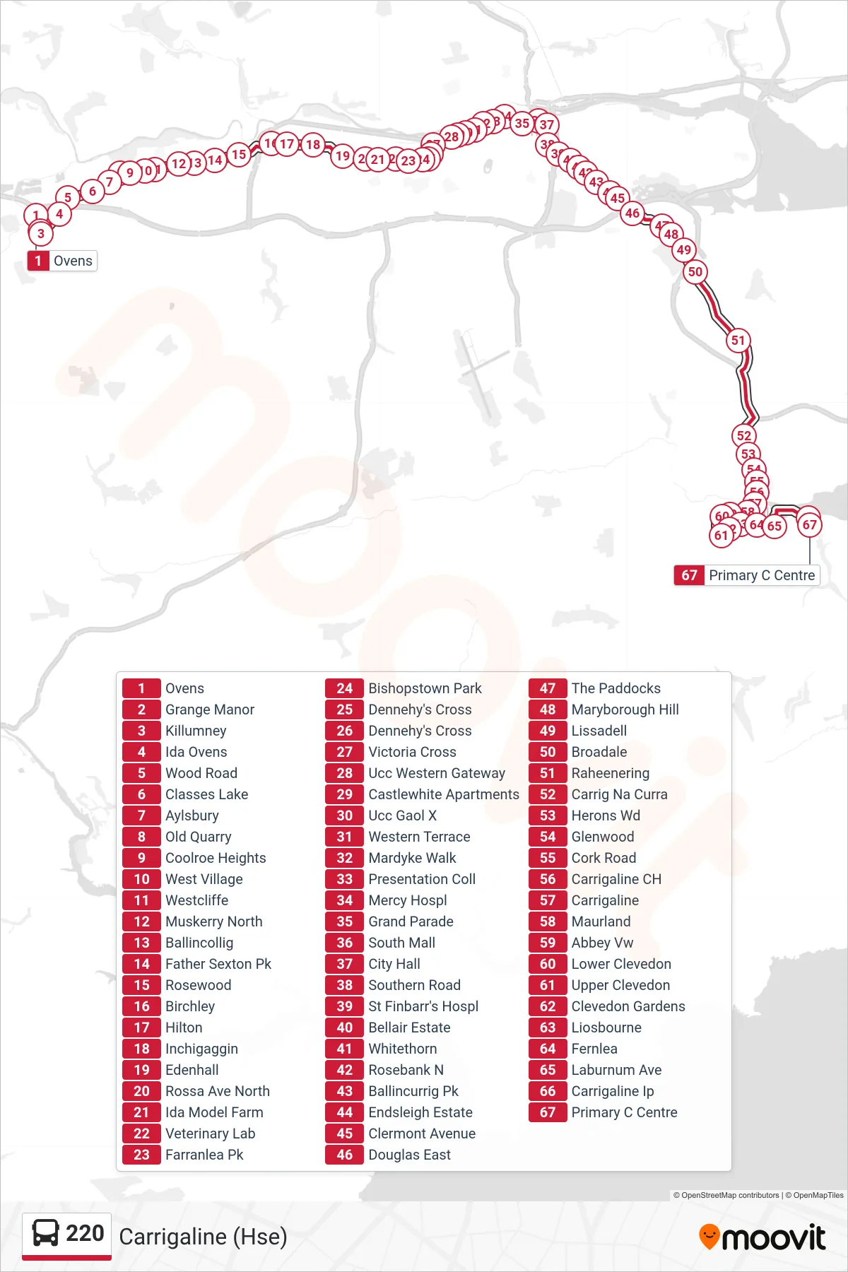
Stops list (220 - Carrigaline (Hse))
- Ovens
- Grange Manor
- Killumney
- Ida Ovens
- Wood Road
- Classes Lake
- Aylsbury
- Old Quarry
- Coolroe Heights
- West Village
- Westcliffe
- Muskerry North
- Ballincollig
- Father Sexton Pk
- Rosewood
- Birchley
- Hilton
- Inchigaggin
- Edenhall
- Rossa Ave North
- Ida Model Farm
- Veterinary Lab
- Farranlea Pk
- Bishopstown Park
- Dennehy's Cross
- Dennehy's Cross
- Victoria Cross
- Ucc Western Gateway
- Castlewhite Apartments
- Ucc Gaol X
- Western Terrace
- Mardyke Walk
- Presentation Coll
- Mercy Hospl
- Grand Parade
- South Mall
- City Hall
- Southern Road
- St Finbarr's Hospl
- Bellair Estate
- Whitethorn
- Rosebank N
- Ballincurrig Pk
- Endsleigh Estate
- Clermont Avenue
- Douglas East
- The Paddocks
- Maryborough Hill
- Lissadell
- Broadale
- Raheenering
- Carrig Na Curra
- Herons Wd
- Glenwood
- Cork Road
- Carrigaline CH
- Carrigaline
- Maurland
- Abbey Vw
- Lower Clevedon
- Upper Clevedon
- Clevedon Gardens
- Liosbourne
- Fernlea
- Laburnum Ave
- Carrigaline Ip
- Primary C Centre