
220 Bus Route Map
View the 220 route map and see all 220 stops along the route. The map of 220 shows where the bus travels and the location of each stop, making it easy to understand the entire route at a glance.
Explore Kavim routes on the map and see where Kavim bus services operate. Use the 220 map to find bus stops and see how the 220 connects different areas along its trip.
All 220 stops on the map are displayed in route order, helping you follow the 220 bus from the first stop to the last.
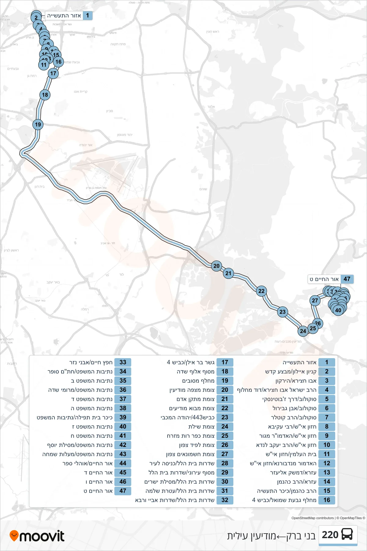
Stops list (220 - Bnei Brak→Modi'in Illit)
- Industrial Zone
- Ayalon Mall/Mivtza Kadesh
- Abu Hatzeira/HaYarkon
- Rabbi Israel Abu Hatzeira/David Machluf
- Jabotinsky Road/Sokolov
- Sokolov/Jabotinsky Road
- Sokolov/Ibn Gabirol
- Sokolov/HaRav Kotler
- Hazon Ish/Rabbi Akiva
- Hazon Ish/Admor of Gur
- Chazon Ish/Rabbi Yaakov Landa
- Cemetery/Chazon Ish
- Admor of Nadvorna/Chazon Ish
- Ezra/Damesek Eliezer
- Ezra/HaRav Kahanan
- Rabbi Kahaneman/Industry Square
- Givat Shmuel Interchange/Road 4
- Bar Ilan Bridge/Road 4
- Aluf Sadeh Terminal
- Mesubim Interchange
- Mitzpe Modi'in Junction
- Adam Facility Junction
- Mevo Modi'im Junction
- Road 443/Yehuda HaMaccabi
- Shilat Junction
- East Kfar Ruth Junction
- Lapid North Junction
- Hashmonaim North Junction
- Beit Hillel Boulevard/City Entrance
- City Terminal/Beit Hillel Boulevard
- Beit Hillel Boulevard/Mesilat Yesharim
- Beit Hillel Boulevard/Ateret Shlomo
- Beit Hillel Boulevard/Abaye VeRava Boulevard
- Chafetz Chaim/Avnei Nezer
- Netivot HaMishpat/Chatam Sofer
- Netivot HaMishpat B
- Netivot HaMishpat/Meromei Sadeh
- Netivot HaMishpat D
- Netivot HaMishpat E
- Prayer House Square/Netivot HaMishpat
- Netivot HaMishpat 7
- Netivot HaMishpat 8
- Netivot HaMishpat/Mesilat Yosef
- Netivot HaMishpat/Maalot Simcha
- Or HaChaim/Ohalei Sefer
- Or HaChaim D
- Or HaChaim F
- Or HaChaim I