
224 Bus Route Map
View the 224 route map and see all 224 stops along the route. The map of 224 shows where the bus travels and the location of each stop, making it easy to understand the entire route at a glance.
Explore GTT Suburban Service routes on the map and see where GTT Suburban Service bus services operate. Use the 224 map to find bus stops and see how the 224 connects different areas along its trip.
All 224 stops on the map are displayed in route order, helping you follow the 224 bus from the first stop to the last.
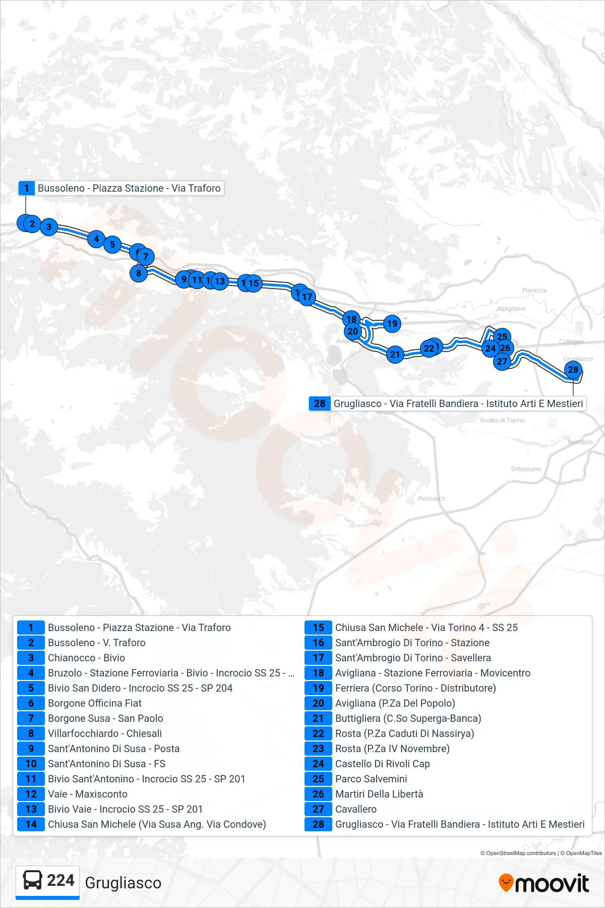
Stops list (224 - Grugliasco)
- Bussoleno - Station Square - Tunnel Street
- Bussoleno - Tunnel Street
- Chianocco - Junction
- Bruzolo - Railway Station - Junction - SS 25 Intersection - SP 205
- San Didero Junction - SS 25 - SP 204 Intersection
- Borgone Fiat Factory
- Borgone Susa - San Paolo
- Villarfocchiardo - Chiesali
- Sant'Antonino Di Susa - Post Office
- Sant'Antonino Di Susa - Railway Station
- Sant'Antonino Junction - Intersection SS 25 - SP 201
- Vaie - Maxisconto
- Bivio Vaie - SS 25 Junction - SP 201
- Chiusa San Michele (Susa Street Corner Condove Street)
- Chiusa San Michele - Via Torino 4 - SS 25
- Sant'Ambrogio Di Torino - Station
- Sant'Ambrogio Di Torino - Savellera
- Avigliana - Railway Station - Transport Center
- Ferriera (Torino Avenue - Gas Station)
- Avigliana (People's Square)
- Buttigliera (Superga Course-Bank)
- Rosta (Nassirya Fallen Square)
- Rosta (November 4th Square)
- Castello Di Rivoli Terminal
- Salvemini Park
- Liberty Martyrs
- Cavallero
- Grugliasco - Via Fratelli Bandiera - Arts and Crafts Institute