
225 Bus Route Map
View the 225 route map and see all 225 stops along the route. The map of 225 shows where the bus travels and the location of each stop, making it easy to understand the entire route at a glance.
Explore Regional Transportation District routes on the map and see where Regional Transportation District bus services operate. Use the 225 map to find bus stops and see how the 225 connects different areas along its trip.
All 225 stops on the map are displayed in route order, helping you follow the 225 bus from the first stop to the last.
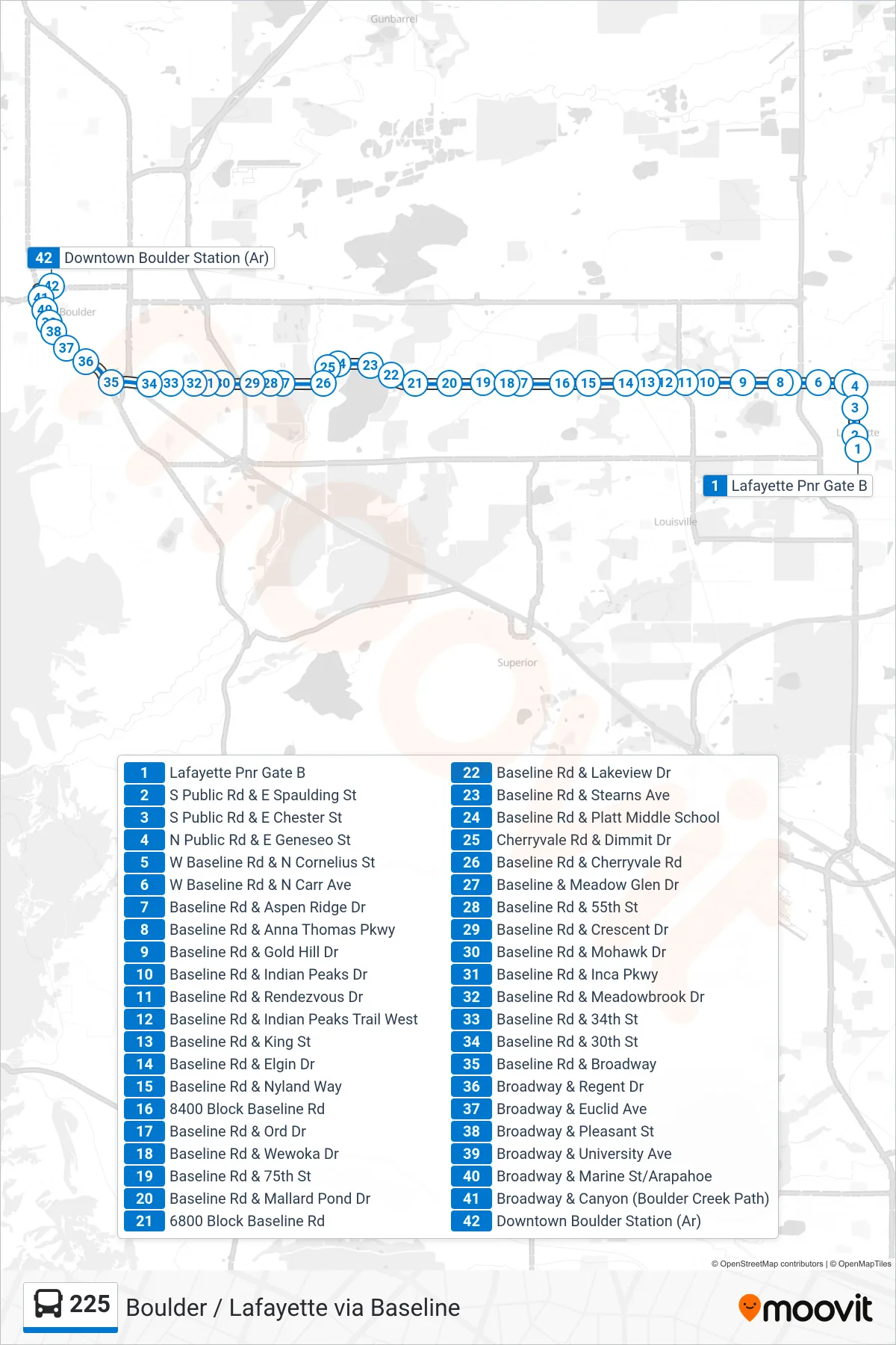
Stops list (225 - Dtwn Boulder)
- Lafayette Pnr Gate B
- S Public Rd & E Spaulding St
- S Public Rd & E Chester St
- N Public Rd & E Geneseo St
- W Baseline Rd & N Cornelius St
- W Baseline Rd & N Carr Ave
- Baseline Rd & Aspen Ridge Dr
- Baseline Rd & Anna Thomas Pkwy
- Baseline Rd & Gold Hill Dr
- Baseline Rd & Indian Peaks Dr
- Baseline Rd & Rendezvous Dr
- Baseline Rd & Indian Peaks Trail West
- Baseline Rd & King St
- Baseline Rd & Elgin Dr
- Baseline Rd & Nyland Way
- 8400 Block Baseline Rd
- Baseline Rd & Ord Dr
- Baseline Rd & Wewoka Dr
- Baseline Rd & 75th St
- Baseline Rd & Mallard Pond Dr
- 6800 Block Baseline Rd
- Baseline Rd & Lakeview Dr
- Baseline Rd & Stearns Ave
- Baseline Rd & Platt Middle School
- Cherryvale Rd & Dimmit Dr
- Baseline Rd & Cherryvale Rd
- Baseline & Meadow Glen Dr
- Baseline Rd & 55th St
- Baseline Rd & Crescent Dr
- Baseline Rd & Mohawk Dr
- Baseline Rd & Inca Pkwy
- Baseline Rd & Meadowbrook Dr
- Baseline Rd & 34th St
- Baseline Rd & 30th St
- Baseline Rd & Broadway
- Broadway & Regent Dr
- Broadway & Euclid Ave
- Broadway & Pleasant St
- Broadway & University Ave
- Broadway & Marine St/Arapahoe
- Broadway & Canyon (Boulder Creek Path)
- Downtown Boulder Station (Ar)