
226 Bus Route Map
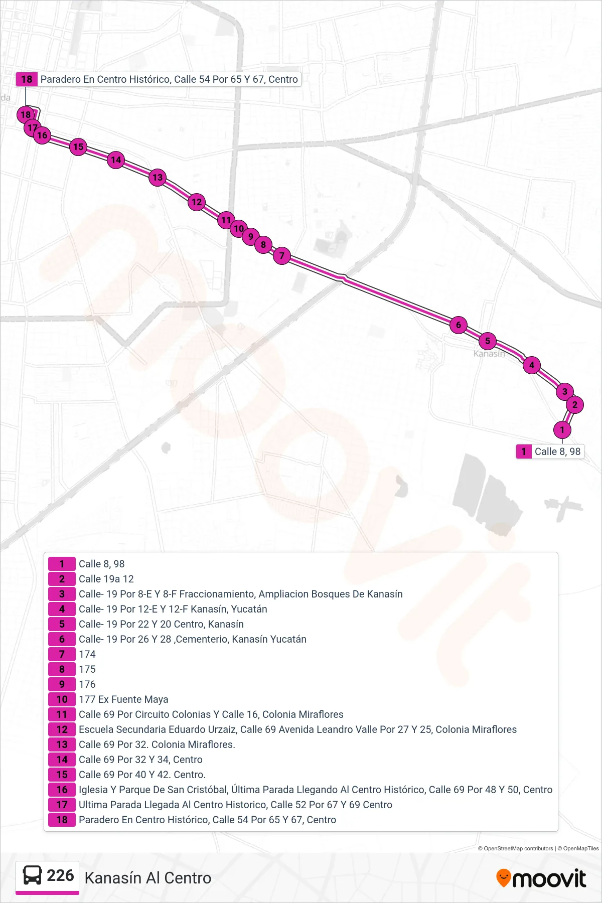
View the 226 route map and see all 226 stops along the route. The map of 226 shows where the bus travels and the location of each stop, making it easy to understand the entire route at a glance.
Explore Autobuses routes on the map and see where Autobuses bus services operate. Use the 226 map to find bus stops and see how the 226 connects different areas along its trip.
All 226 stops on the map are displayed in route order, helping you follow the 226 bus from the first stop to the last.
Stops list (226 - Kanasín Al Centro)
- Calle 8, 98
- Calle 19a 12
- Calle- 19 Por 8-E Y 8-F Fraccionamiento, Ampliacion Bosques De Kanasín
- Calle- 19 Por 12-E Y 12-F Kanasín, Yucatán
- Calle- 19 Por 22 Y 20 Centro, Kanasín
- Calle- 19 Por 26 Y 28 ,Cementerio, Kanasín Yucatán
- 174
- 175
- 176
- 177 Ex Fuente Maya
- Calle 69 Por Circuito Colonias Y Calle 16, Colonia Miraflores
- Escuela Secundaria Eduardo Urzaiz, Calle 69 Avenida Leandro Valle Por 27 Y 25, Colonia Miraflores
- Calle 69 Por 32. Colonia Miraflores.
- Calle 69 Por 32 Y 34, Centro
- Calle 69 Por 40 Y 42. Centro.
- Iglesia Y Parque De San Cristóbal, Última Parada Llegando Al Centro Histórico, Calle 69 Por 48 Y 50, Centro
- Ultima Parada Llegada Al Centro Historico, Calle 52 Por 67 Y 69 Centro
- Paradero En Centro Histórico, Calle 54 Por 65 Y 67, Centro